SOUTH AFRICA
SOUTH AFRICA THE RAINBOW NATION
Bordered by two oceans and the Atlantic and the Indian, South Africa is a fascinating country whether one focuses on its history, the diversity of its inhabitants? cultures, or the splendour of its landscape.
The first Dutch sailors set foot at the Cape of Good Hope in April 1652, a first step that would eventually lead to three and a half centuries of conflict and violence, shaping the destiny of the people of South Africa. From the British occupation to the reign of the Great Shaka of the Zulus, from the Great Trek to the Anglo-Boer wars, from the official onset of Apartheid to the election of Nelson Mandela in 1994, history has left its mark in the memories of South Africans.
Now, however, South Africa is a democratic country of about 46 million inhabitants, and 11 official languages: Afrikaans, English, Xhosa and Zulu being dominant. To describe their country, Desmond Tutu and Nelson Mandela use the expression “The Rainbow Nation”.
With its 3000 kilometre-long coastline, its tropical beaches, mountain ranges, bush areas and deserts, South Africa is also a land of natural beauties. Numerous National Parks teeming with flora and big game allow for many an opportunity to go on memorable scenic- and game-drives. Each and every area boasts a typical flora and fauna. Among others, one might expect to spot lions, cheetahs, elephants, giraffes, eagles and ostriches, seals, penguins, whales and many more. South Africa is a paradise for nature lovers.
CAPE TOWN & CAPE PENINSULA
CAPE TOWN
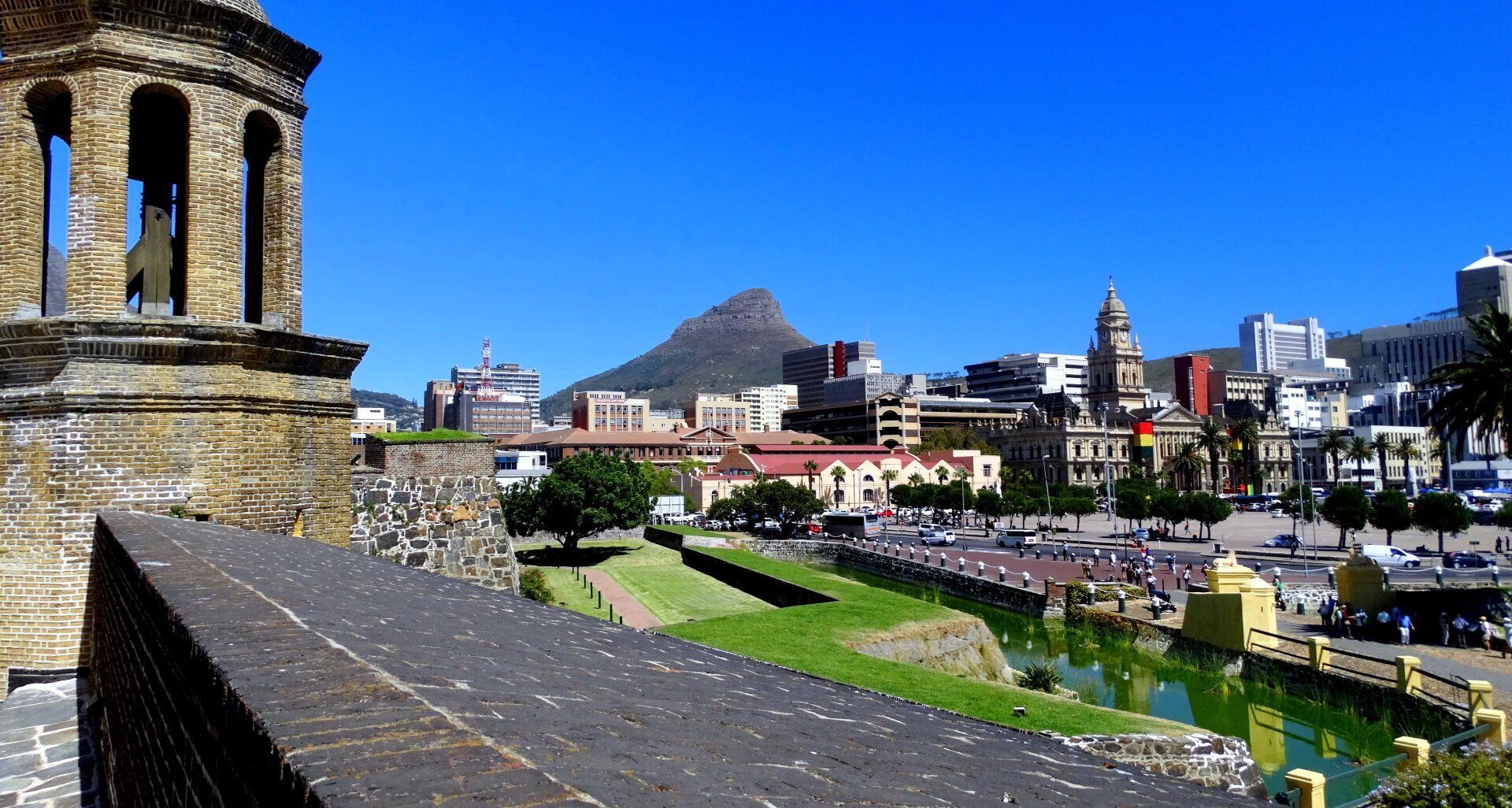
Located 40 kilometres from the Cape of Good Hope, Cape Town is one of the most isolated metropolises in the world. Cape Town’s city centre lies cradled in a vast blue-grey amphitheatre formed by Table Mountain, Lion’s Head and Devil’s Peak. Few cities in the world can boast a more spectacular setting and it is certainly unrivalled in South Africa for its cosmopolitan ambience redolent with history.
In its three-and-a-half centuries, the city has transformed itself from a remote colonial outpost to one of Africa’s most important cities. This teeming metropolis is a major commercial, financial and industrial centre and one of the southern hemisphere’s premier ports for container shipping and the export of fruit. It is also quickly gaining a reputation as one of the loveliest holiday destinations worldwide, with its idyllic summers and majestic, stormy winter seasons.
The city centre includes the historic centre and residential districts, the Waterfront (the old harbour was transformed into an extensive shopping centre with cinemas, hotels, restaurants and bars) and the modern harbour. The rest of Cape Town is comprised of a series of suburbs and residential areas spreading around Table Mountain. Like many other South African cities, Cape Town is a city of contrasts. Not really European and not totally African, it is a curious blend of the Third World and the First. The diversity of its population and the number of varied districts make Cape Town a hybrid city set between two oceans.
TABLE MOUNTAIN
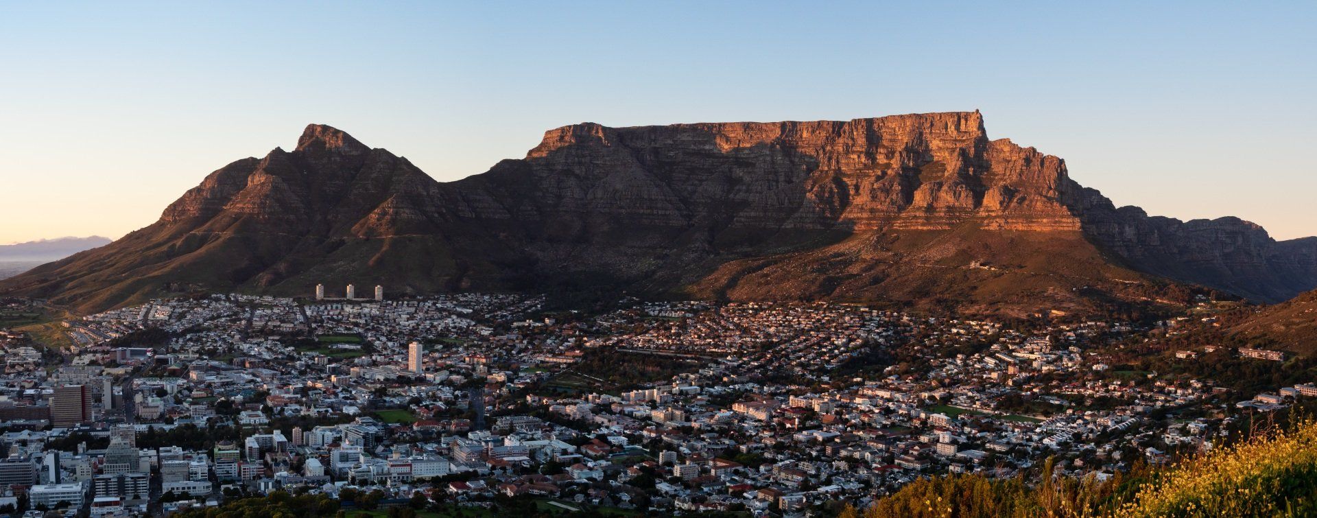
Since the first person laid eyes on Table Mountain, it has exerted its powerful and charismatic pull, enchanting and drawing any and all who fall under its spell. The best views of Cape Town are seen from the top of Table Mountain. The Cableway summit is under 10 minutes and the cable car’s rotating floor ensures that all passengers have an aerial view of the city. Table Mountain is a sandstone plateau rising up above the Cape Flats. The top is approximately 3km wide, and at its highest point, Maclears Beacon, rises to 1085m. Over the centuries it has become one of South Africa's most famous landmarks. The steep cliffs and rocky outcrops of the mountain play home to a number of plants and animals. The mountain is home to approximately 1470 species of plants; more than the entire British Isles! Complimenting this vast array of flora is a stunning range of fauna, some, like the Table Mountain Ghost Frog, being found in no other place in the world.
CAPE PENINSULA NATIONAL PARK
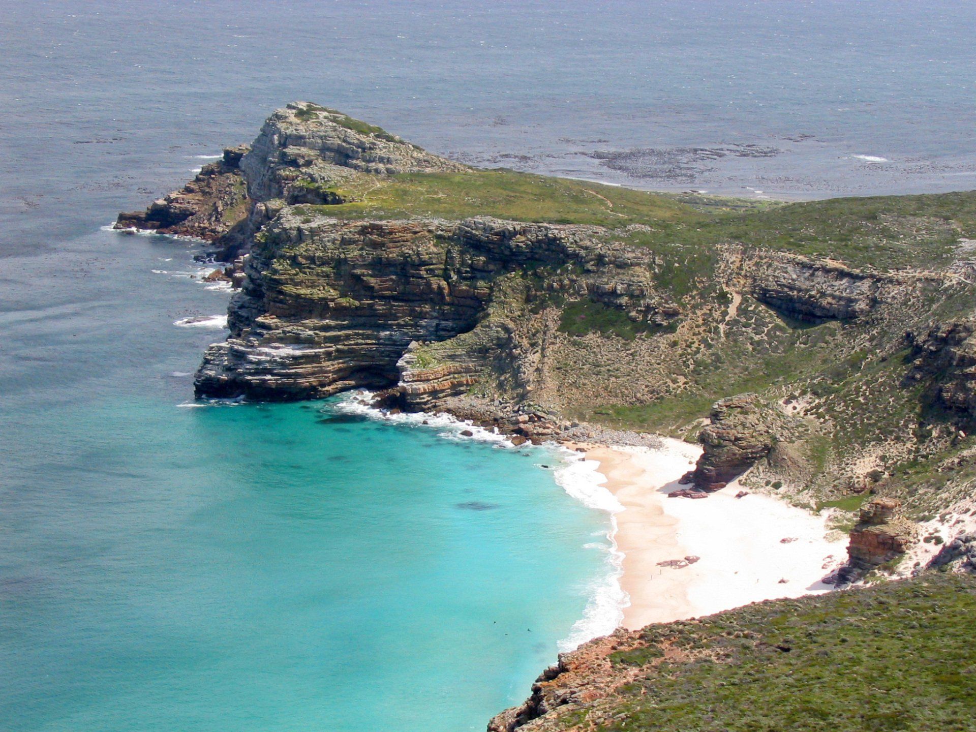
“The fairest Cape we saw in the whole circumference of the Earth”, the great navigator Francis Drake exclaimed when he sailed into Table Bay in 1580. Through the centuries, it has been called many names of which "The Cape of Storms" (by Bartholomeu Dias) and "The Cape of Good Hope" (by the King of Portugal) are but two examples. During the 17th and 18th Centuries, sailors called it the "Tavern of the Seas" because fresh produce was grown locally and also shipped in, and later sold, to passing merchant ships. Nowadays, South Africans simply call it “the Cape”, an acknowledgement of its status as the Mother City of South Africa.
The Cape Point Nature Reserve is situated within the Table Mountain National Park. As part of one of the Floral Kingdoms of the world, there are more species of plants in the Cape Peninsula National Park (7,750 hectares) than the entire British Isles. Some of these species are unique to the Cape, with 30 actually threatened with extinction. The vegetation of the Peninsula is characterised by “fynbos” (proteas and moorland). Moreover, baboons, wildebeest, mountain zebras, porcupines and ostriches as well as abundant birdlife are present in the park.
CAPE TOWN
Located 40 kilometres from the Cape of Good Hope, Cape Town is one of the most isolated metropolises in the world. Cape Town’s city centre lies cradled in a vast blue-grey amphitheatre formed by Table Mountain, Lion’s Head and Devil’s Peak. Few cities in the world can boast a more spectacular setting and it is certainly unrivalled in South Africa for its cosmopolitan ambience redolent with history.
In its three-and-a-half centuries, the city has transformed itself from a remote colonial outpost to one of Africa’s most important cities. This teeming metropolis is a major commercial, financial and industrial centre and one of the southern hemisphere’s premier ports for container shipping and the export of fruit. It is also quickly gaining a reputation as one of the loveliest holiday destinations worldwide, with its idyllic summers and majestic, stormy winter seasons.
The city centre includes the historic centre and residential districts, the Waterfront (the old harbour was transformed into an extensive shopping centre with cinemas, hotels, restaurants and bars) and the modern harbour. The rest of Cape Town is comprised of a series of suburbs and residential areas spreading around Table Mountain. Like many other South African cities, Cape Town is a city of contrasts. Not really European and not totally African, it is a curious blend of the Third World and the First. The diversity of its population and the number of varied districts make Cape Town a hybrid city set between two oceans.
Slide title
Write your caption hereButton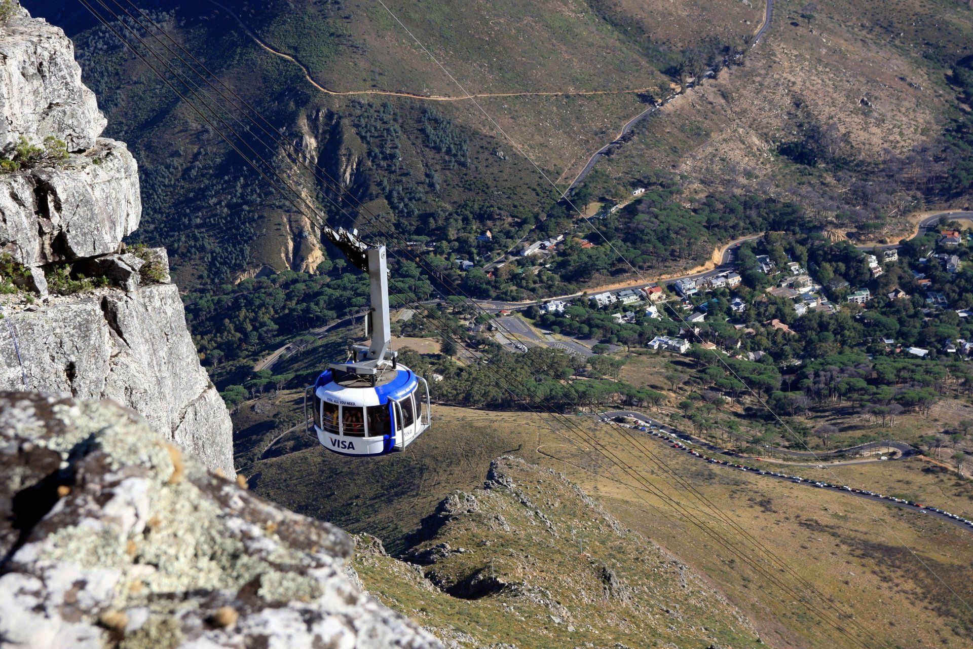
Slide title
Write your caption hereButton
TABLE MOUNTAIN
Since the first person laid eyes on Table Mountain, it has exerted its powerful and charismatic pull, enchanting and drawing any and all who fall under its spell. The best views of Cape Town are seen from the top of Table Mountain. The Cableway summit is under 10 minutes and the cable car’s rotating floor ensures that all passengers have an aerial view of the city. Table Mountain is a sandstone plateau rising up above the Cape Flats. The top is approximately 3km wide, and at its highest point, Maclears Beacon, rises to 1085m. Over the centuries it has become one of South Africa's most famous landmarks. The steep cliffs and rocky outcrops of the mountain play home to a number of plants and animals. The mountain is home to approximately 1470 species of plants; more than the entire British Isles! Complimenting this vast array of flora is a stunning range of fauna, some, like the Table Mountain Ghost Frog, being found in no other place in the world.
CAPE PENINSULA NATIONAL PARK
“The fairest Cape we saw in the whole circumference of the Earth”, the great navigator Francis Drake exclaimed when he sailed into Table Bay in 1580. Through the centuries, it has been called many names of which "The Cape of Storms" (by Bartholomeu Dias) and "The Cape of Good Hope" (by the King of Portugal) are but two examples. During the 17th and 18th Centuries, sailors called it the "Tavern of the Seas" because fresh produce was grown locally and also shipped in, and later sold, to passing merchant ships. Nowadays, South Africans simply call it “the Cape”, an acknowledgement of its status as the Mother City of South Africa.
The Cape Point Nature Reserve is situated within the Table Mountain National Park. As part of one of the Floral Kingdoms of the world, there are more species of plants in the Cape Peninsula National Park (7,750 hectares) than the entire British Isles. Some of these species are unique to the Cape, with 30 actually threatened with extinction. The vegetation of the Peninsula is characterised by “fynbos” (proteas and moorland). Moreover, baboons, wildebeest, mountain zebras, porcupines and ostriches as well as abundant birdlife are present in the park.
WINELANDS
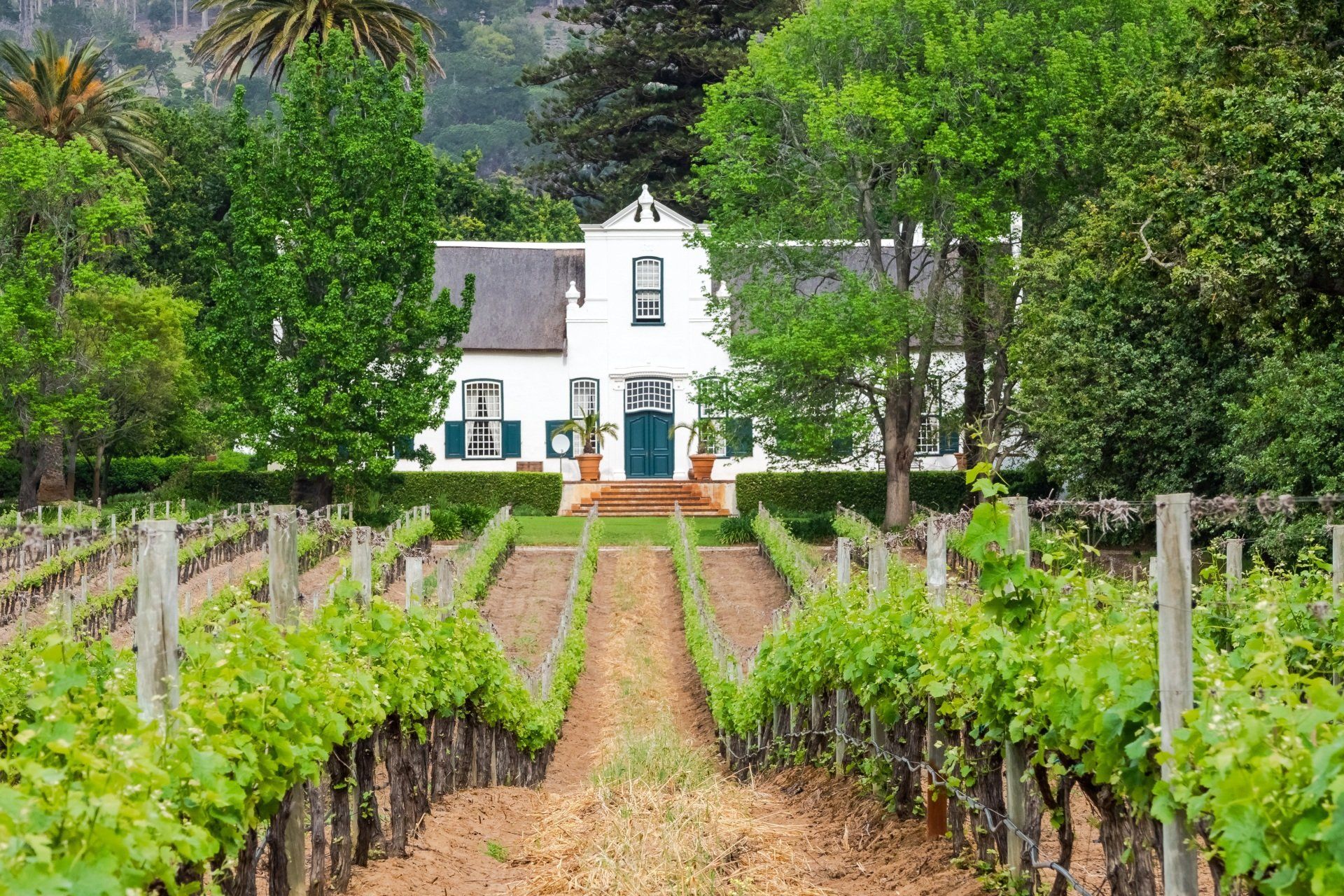
THE CAPE WINELANDS
Today the Cape’s wine industry as well as the historic estate homesteads is one of the country’s most highly treasured assets. The first consignment of vines from German, French, Spanish and Bohemian vineyards arrived in the Cape in 1655. Jan Van Riebeek, then governor of the area, recorded in his diary on 2nd February 1659 that “Today, for the first time, the Lord be praised, wine was made from Cape grapes”.
Professional winemaking in the Cape began only after Simon van der Stel, the new commander of the settlement and future governor of the East India Company, founded the second oldest Dutch settlement in South Africa. It was named Stellenbosch, after himself, and is situated in a sunny and fertile valley to the east of Cape Town.
A great boost was given to wine production in South Africa by the arrival of Huguenot refugees from France, who settled around Franschhoek (“French Corner”), to the east of Paarl and Stellenbosch, between 1688 and 1690, and developed what is still an important wine-growing region. At the end of the 19th century, phylloxera ravaged South Africa’s vineyards, but by importing phylloxera resistant vines from America, South African winegrowers managed to reach their previous production level again by 1918.
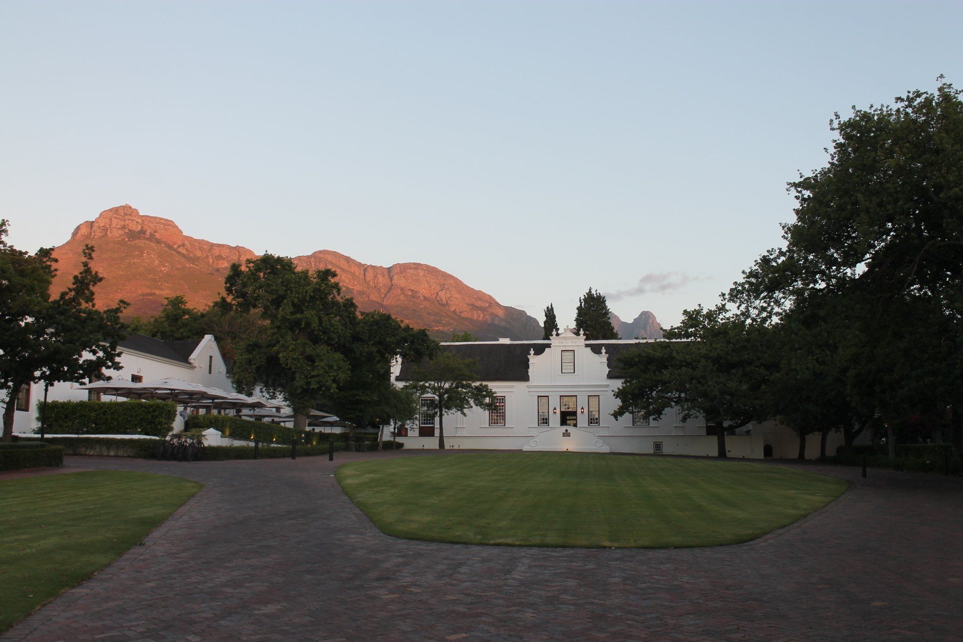
STELLENBOSCH
Stellenbosch is named after governor Simon Van der Stel (Van der Stels Bosch) who visit the ara in 1679, at that stage known as Wildenbosch. He was taken by the natural beauty and fertile soil. During the same year, the first colonist were granted farms. Stellenbosch is the second oldest town in South Africa after Cape Town, about 50 km south from Stellenbosch.
Stellenbosch is an important centre of the South African wine industry. Tourist like the town for its many Cape Dutch homes. Especially Dorp Street is very attractive offering many national monuments and the famous Oom Samies se winkel. The many oak trees in town originate out of the days when the town was still an agricultural area which is also the reason why Stellenbosch is also known as the 'Eikestad' (eik = oak, stad = city). As European oak trees grow too fast in the mild climate, they became quickly sponge and so not suitable for the wine barrel production.
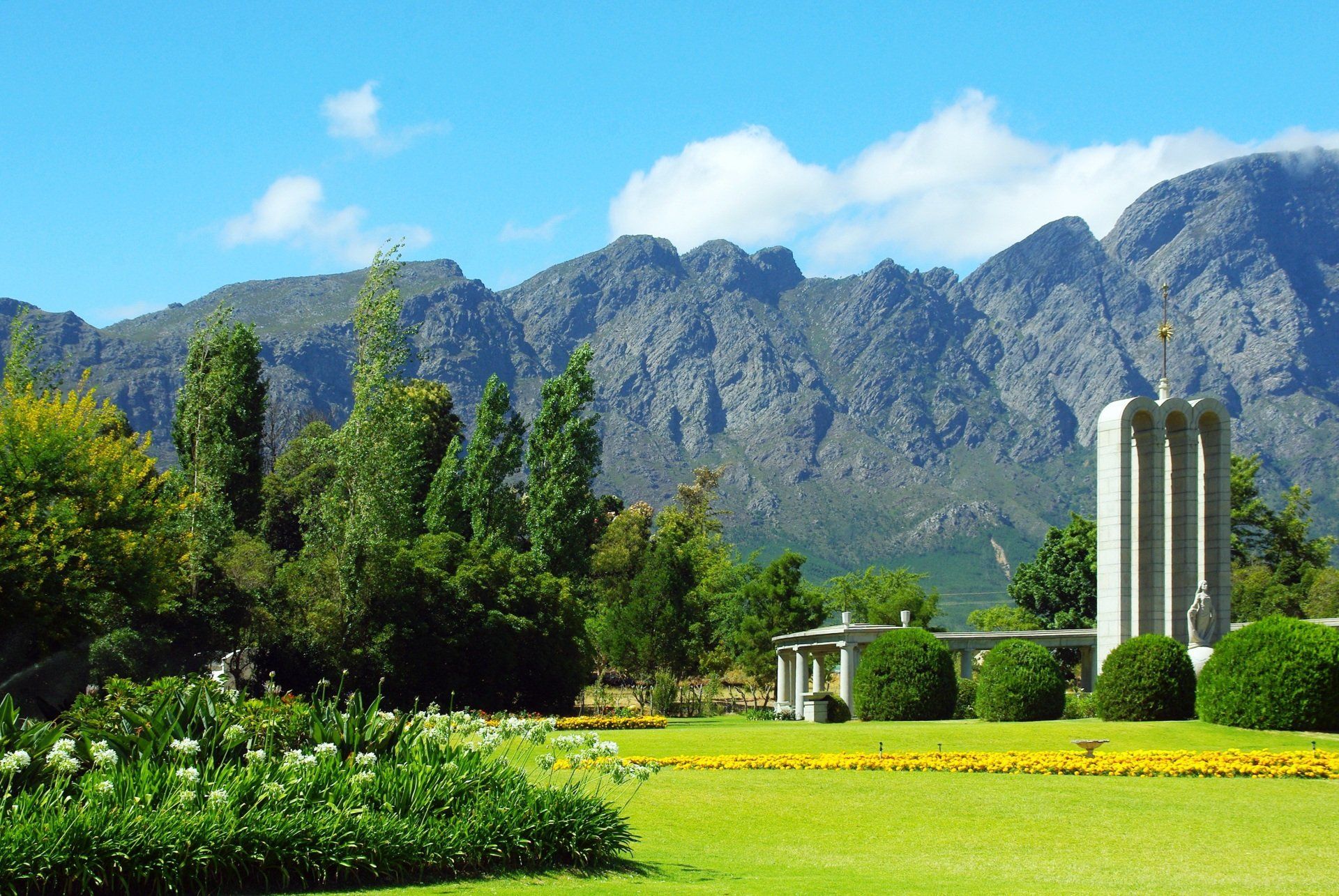
FRANSCHHOEK
Nestled in the Cape winelands, Franschhoek was named after the French Huguenots who settled here at the end of the 17th Century. The Huguenots were French Protestants who fled from religious persecution after the revoking of the Edict of Nantes in 1685. At that time, the Dutch East India Company, wanting to strengthen the Cape settlement, announced that “French Huguenots, especially those having a knowledge in vine culture, vinegar and spirits making” would be more than welcome. After a long journey by boat, about 200 French Huguenots arrived in a valley surrounded by mountains called Drakenstein and Olifantshoek (the elephant corner). It was soon renamed Franschhoek (the French corner).
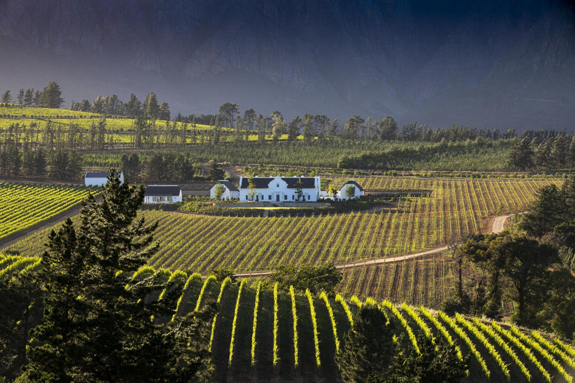
PAARL
Surrounded by mountains and vineyards, Paarl is a commercial centre on the banks of the Berg River. There are actually vineyards and wineries within the sprawling town limits, including the huge 'Kooperatieve Wijnbouwers Vereniging', a co-operative that both regulates and dominates the South African wine industry. There is some excellent Cape Dutch architecture in the area, and some significant monuments to the Afrikaner culture. Europeans settled in the surrounding valley in the 1680s and Paarl was established in 1720. It became a centre for wagon building, but it is most famous for its important role in the development and recognition of Afrikaans as a separate language.
THE CAPE WINELANDS
Today the Cape’s wine industry as well as the historic estate homesteads is one of the country’s most highly treasured assets. The first consignment of vines from German, French, Spanish and Bohemian vineyards arrived in the Cape in 1655. Jan Van Riebeek, then governor of the area, recorded in his diary on 2nd February 1659 that “Today, for the first time, the Lord be praised, wine was made from Cape grapes”.
Professional winemaking in the Cape began only after Simon van der Stel, the new commander of the settlement and future governor of the East India Company, founded the second oldest Dutch settlement in South Africa. It was named Stellenbosch, after himself, and is situated in a sunny and fertile valley to the east of Cape Town.
A great boost was given to wine production in South Africa by the arrival of Huguenot refugees from France, who settled around Franschhoek (“French Corner”), to the east of Paarl and Stellenbosch, between 1688 and 1690, and developed what is still an important wine-growing region. At the end of the 19th century, phylloxera ravaged South Africa’s vineyards, but by importing phylloxera resistant vines from America, South African winegrowers managed to reach their previous production level again by 1918.
STELLENBOSCH
Stellenbosch is named after governor Simon Van der Stel (Van der Stels Bosch) who visit the ara in 1679, at that stage known as Wildenbosch. He was taken by the natural beauty and fertile soil. During the same year, the first colonist were granted farms. Stellenbosch is the second oldest town in South Africa after Cape Town, about 50 km south from Stellenbosch.
Stellenbosch is an important centre of the South African wine industry. Tourist like the town for its many Cape Dutch homes. Especially Dorp Street is very attractive offering many national monuments and the famous Oom Samies se winkel. The many oak trees in town originate out of the days when the town was still an agricultural area which is also the reason why Stellenbosch is also known as the 'Eikestad' (eik = oak, stad = city). As European oak trees grow too fast in the mild climate, they became quickly sponge and so not suitable for the wine barrel production.
FRANSCHHOEK
Nestled in the Cape winelands, Franschhoek was named after the French Huguenots who settled here at the end of the 17th Century. The Huguenots were French Protestants who fled from religious persecution after the revoking of the Edict of Nantes in 1685. At that time, the Dutch East India Company, wanting to strengthen the Cape settlement, announced that “French Huguenots, especially those having a knowledge in vine culture, vinegar and spirits making” would be more than welcome. After a long journey by boat, about 200 French Huguenots arrived in a valley surrounded by mountains called Drakenstein and Olifantshoek (the elephant corner). It was soon renamed Franschhoek (the French corner).
PAARL
Surrounded by mountains and vineyards, Paarl is a commercial centre on the banks of the Berg River. There are actually vineyards and wineries within the sprawling town limits, including the huge 'Kooperatieve Wijnbouwers Vereniging', a co-operative that both regulates and dominates the South African wine industry. There is some excellent Cape Dutch architecture in the area, and some significant monuments to the Afrikaner culture. Europeans settled in the surrounding valley in the 1680s and Paarl was established in 1720. It became a centre for wagon building, but it is most famous for its important role in the development and recognition of Afrikaans as a separate language.
WEST COAST
Slide title
Write your caption hereButton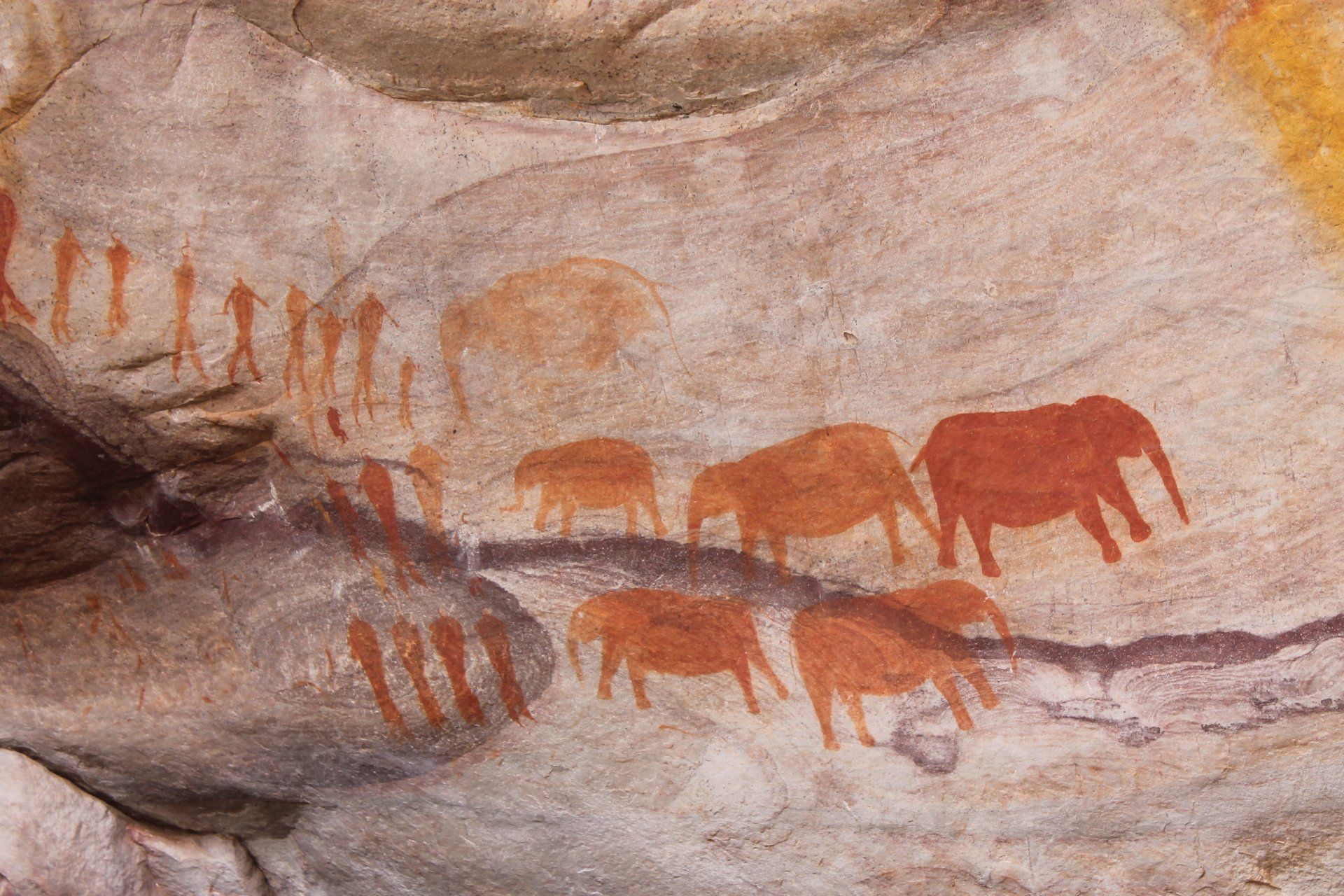
Slide title
Write your caption hereButton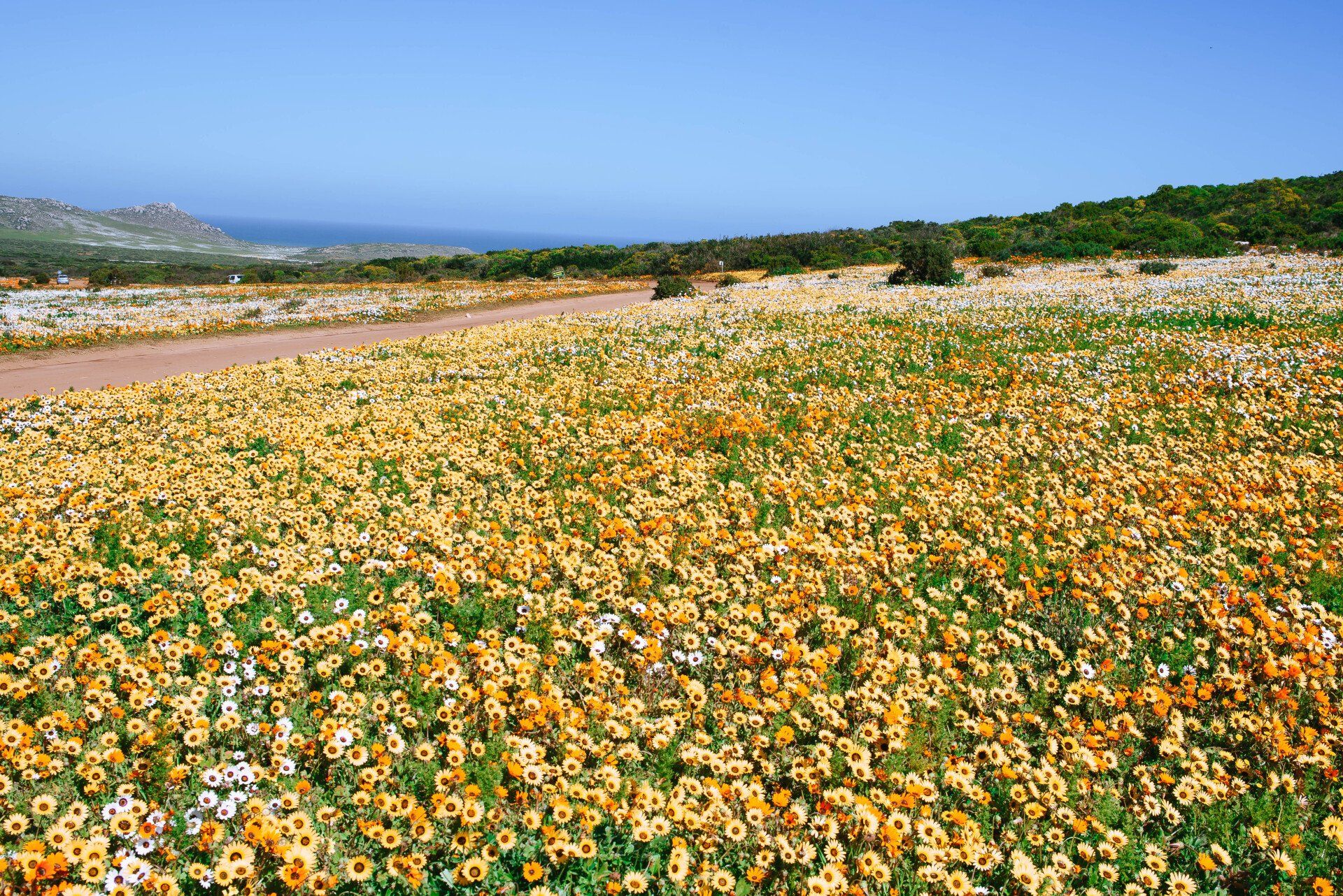
Slide title
Write your caption hereButton
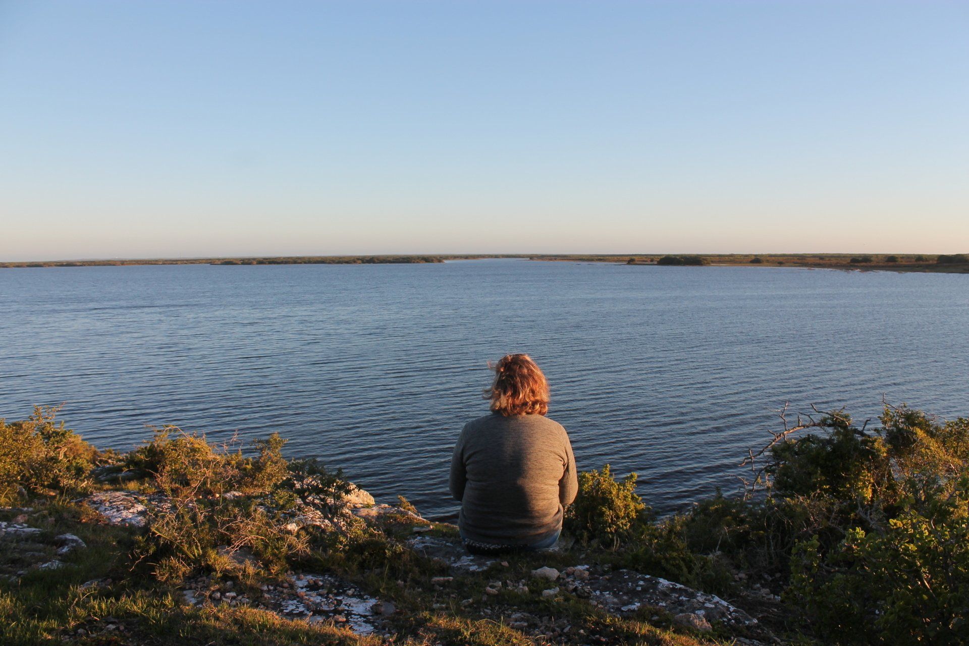
WEST COAST NATIONAL PARK
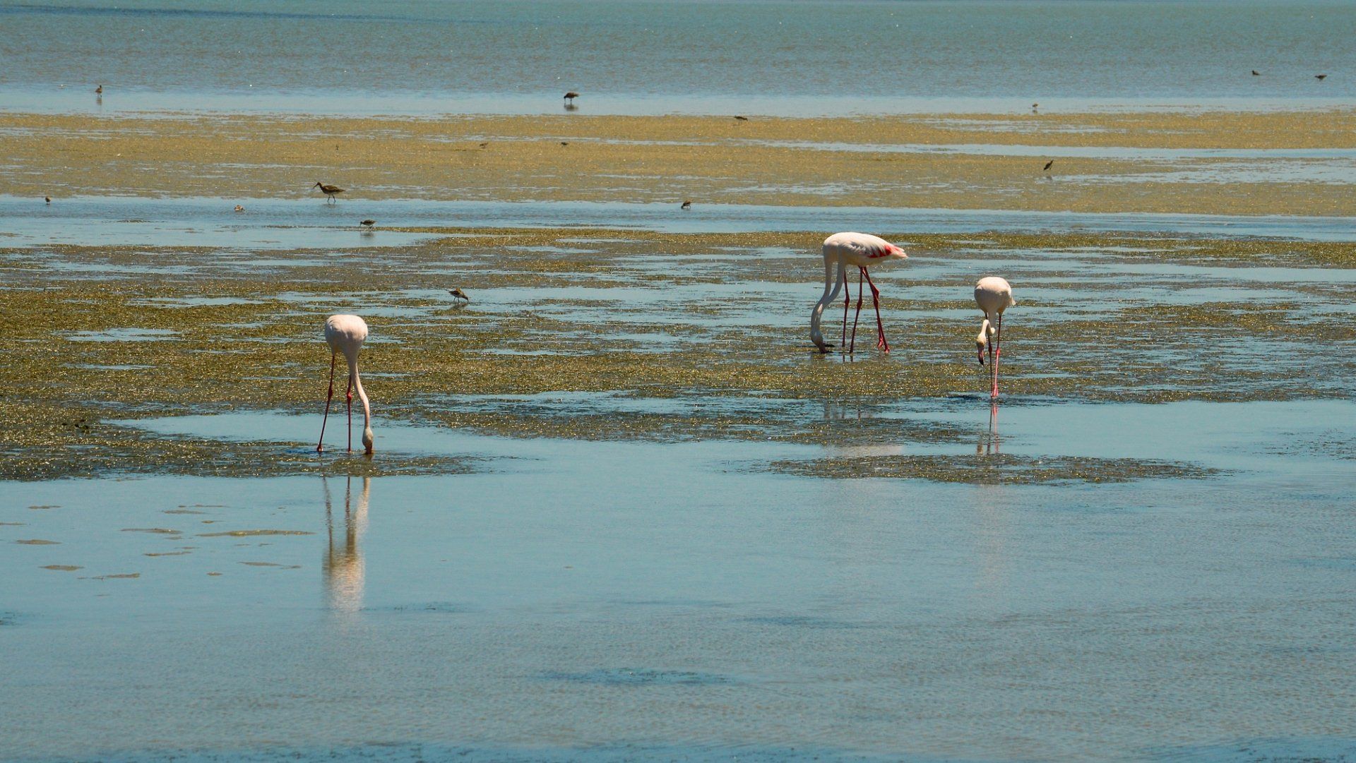
Located to the north of the village of Yzerfontein lies the 18 000 hectares West Coast National Park. It encloses the Langebaan Lagoon that measures up to 16 km in length and 4.5 km across, as well as the nearby islands of Jutten, Malgas, Schaapen and Marcus. Important seabird breeding colonies, as well as numerous waders are found here – the most common ones being cormorants, gulls, gannets and flamingos. During summer, seasonal migrants such as the Curlew Sandpiper from the Arctic region swell the numbers in the lagoon. The park also proudly displays its annual spring wildflower kaleidoscope of bright colours (+/- August – September). Game species such as the wildebeest can be seen roaming around the park. The Postberg section, famous for its needle rocks is only open to the public during flower season!
CLANWILLIAM
Clanwilliam is in the centre of various flower (in season) and historical routes, hiking trails and rock art viewing. This heart of the Rooibos world includes farming in fruit, vegetables, and sheep and is known for its veldskoen factory. The Clanwilliam Dam Resort is a popular holiday destination for water sport enthusiasts and angling. The Ramskop Nature Reserve at the dam is home to numerous endemic wild flower species and is a popular visiting spot in August and September.
NAMAQUALAND & FLOWERS
The West Coast region skirts the Atlantic Ocean from Bloubergstrand just north of Cape town and the provincial border between the Northern Cape and the Western Cape. Namaqualand is a strip of land famous for its spectacular fields of flowers in spring (July – September) and is considered one of the natural wonders in the world.
WEST COAST NATIONAL PARK
Located to the north of the village of Yzerfontein lies the 18 000 hectares West Coast National Park. It encloses the Langebaan Lagoon that measures up to 16 km in length and 4.5 km across, as well as the nearby islands of Jutten, Malgas, Schaapen and Marcus. Important seabird breeding colonies, as well as numerous waders are found here – the most common ones being cormorants, gulls, gannets and flamingos. During summer, seasonal migrants such as the Curlew Sandpiper from the Arctic region swell the numbers in the lagoon. The park also proudly displays its annual spring wildflower kaleidoscope of bright colours (+/- August – September). Game species such as the wildebeest can be seen roaming around the park. The Postberg section, famous for its needle rocks is only open to the public during flower season!
CLANWILLIAM
Clanwilliam is in the centre of various flower (in season) and historical routes, hiking trails and rock art viewing. This heart of the Rooibos world includes farming in fruit, vegetables, and sheep and is known for its veldskoen factory. The Clanwilliam Dam Resort is a popular holiday destination for water sport enthusiasts and angling. The Ramskop Nature Reserve at the dam is home to numerous endemic wild flower species and is a popular visiting spot in August and September.
NAMAQUALAND & FLOWERS
The West Coast region skirts the Atlantic Ocean from Bloubergstrand just north of Cape town and the provincial border between the Northern Cape and the Western Cape. Namaqualand is a strip of land famous for its spectacular fields of flowers in spring (July – September) and is considered one of the natural wonders in the world.
WHALE COAST
WHALES
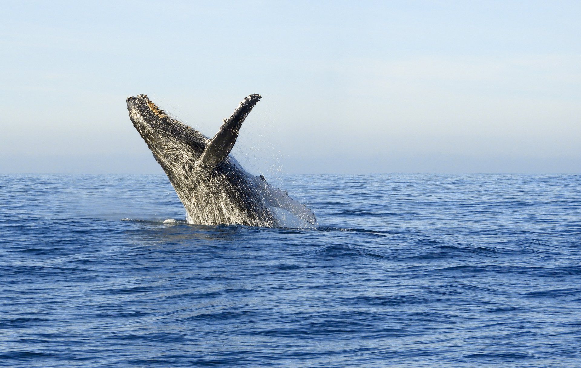
Southern Right Whales are very common in the Cape (which includes West Coast, Cape Peninsula, Overberg/Hermanus/Gansbaai up to Cape Agulhas and the Hoop) between May/June (beginning of the whale season) and up to the end of November. Humback whales, a different species can be spotted throughout the year but they do not come in masses like the Southern Whale does!
The best time is August up to mid November. The babies are usually born between August and September.
WHITE SHARKS
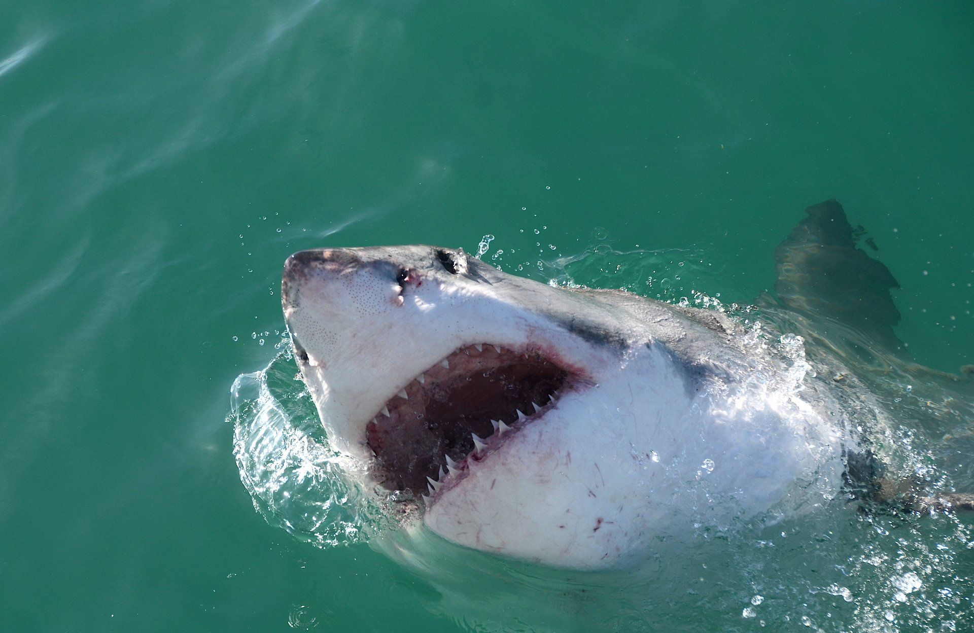
Sharks are spotted regularly throughout the year due to the feeding prospects (seals and penguins) around Dyer Island, however the best time to see Great Whites is generally from February – September (over the South African Winter) as this is when the sharks become more active (most young seals and penguins go into the water during that time of the year). The weather in this region is mildest between April and November so 'High season' for Great White shark spotting in Gansbaai is June and July (the water temperature during that time of the year however is around 12° while sea temperatures reach 16° in summer). Visibility in the water is usually 6-8 meters but can go up to 12-15 meters and down to 2-3 meters on a ‘bad day’. The best viewing months for clear water is between March and September.
Despite the 80 – 90% change of seeing them, they are wild animals and sightings cannot be guaranteed, however it is unlikely that no sharks would be seen. During the trip also whales, penguin, seals and other marine life can be seen.
HERMANUS
Greater Hermanus is situated on a narrow coastal strip between mountains and sea. Rocky hills surround the town with a nature reserve on the outskirts and sandy beaches for swimming and surfing adding to the tranquil setting. It is also reputed to be the ideal spot for whale watching. During the period July to November/December southern right whales come close to the shore to calve and to mate. A whale festival is held during the first week of October, which draws many visitors to the town.
This popular Overberg town was named after the Dutch teacher and shepherd, Hermanus Pieters, who discovered a fresh spring here in the 1830’s. He camped in the area for a few months of the year with his livestock and slowly the news of this beautiful place spread to the surrounding farming districts. The abundance of fish in its seas and a good market base are what led to the establishment of the town of Hermanus in 1904. Over time, Hermanus has developed into a fashionable tourism destination.
CAPE AGULHAS – AFRICA'S MOST SOUTHERN LANDMARK
Agulhas is the southernmost town in Africa and marks the spot where the Indian and Atlantic Oceans meet. Cape Agulhas was so named by Potuguese seafarers at the end of the 15th Century. Translated, it means “Cape of Needles”, referring to the needle of the compass that, at this point, shows no real deviation between true north and magnetic north. The Agulhas Lighthouse (found approximately 1 km from the point where the oceans meet) is the second olenst working lighthouse in South Africa and was erected in 1848. In 1988 it was restored to its original plan.
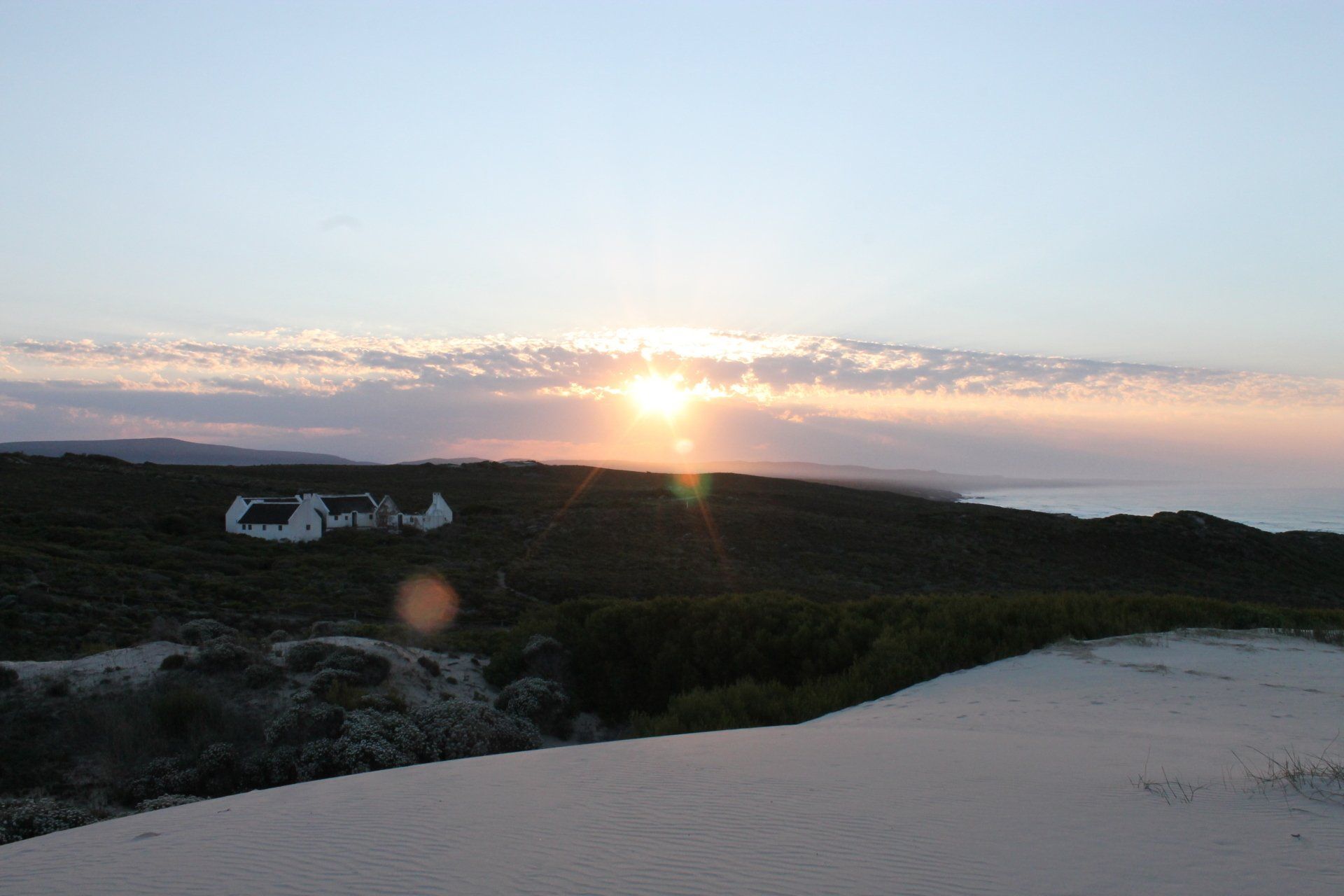
DE HOOP NATURE RESERVE
De Hoop Nature Reserve lies three hours from Cape Town in the Overberg region, near Cape Agulhas, the southern tip of Africa. Approximately 340 square kilometres (130 sq mi) in area, it is one of the largest natural areas managed by Cape Nature.
De Hoop is one of the components of the "Cape Floral Region Protected Areas" World Heritage Site.
De Hoop Nature Reserve is flanked by another protected area, the De Hoop Marine Protected Area, a three nautical mile stretch.
De Hoop Nature Reserve's climate is Mediterranean, with warm summers and mild winters. The reserve gets 380 mm of rain annually. August is the wettest month. In summer, winds blow in from the east, west and southeast, whereas winter has westerly and southwesterly winds.
The vegetation De Hoop Nature Reserve is part of the world's smallest and most threatened plant kingdom, known as the Cape Floral Kingdom. The reserve also contains one of the largest areas of the rare lowland fynbos.
De Hoop is haven for both terrestrial and marine animals. Numerous species inhabit these habitats. The reserve has a total of 86 mammal species. These include the rare bontebok and Cape mountain zebra, eland, grey rhebok, baboon, yellow mongoose and caracal. Leopards, although rare, are also found in the reserve.
The waters within the De Hoop Reserve support good populations of marine mammals such as dolphins and seals. The bays of De Hoop are the breeding grounds for southern right whales. The marine protected area of the reserve has a total of 250 species of fish.
De Hoop supports a large number of resident and migratory bird species. The reserve's total bird species count is 260. Several water birds breed in the reserve. The reserve is also home to the only remaining breeding colony of the rare Cape vulture.
WHALES
Southern Right Whales are very common in the Cape (which includes West Coast, Cape Peninsula, Overberg/Hermanus/Gansbaai up to Cape Agulhas and the Hoop) between May/June (beginning of the whale season) and up to the end of November. Humback whales, a different species can be spotted throughout the year but they do not come in masses like the Southern Whale does!
The best time is August up to mid November. The babies are usually born between August and September.
WHITE SHARKS
Sharks are spotted regularly throughout the year due to the feeding prospects (seals and penguins) around Dyer Island, however the best time to see Great Whites is generally from February – September (over the South African Winter) as this is when the sharks become more active (most young seals and penguins go into the water during that time of the year). The weather in this region is mildest between April and November so 'High season' for Great White shark spotting in Gansbaai is June and July (the water temperature during that time of the year however is around 12° while sea temperatures reach 16° in summer). Visibility in the water is usually 6-8 meters but can go up to 12-15 meters and down to 2-3 meters on a ‘bad day’. The best viewing months for clear water is between March and September.
Despite the 80 – 90% change of seeing them, they are wild animals and sightings cannot be guaranteed, however it is unlikely that no sharks would be seen. During the trip also whales, penguin, seals and other marine life can be seen.
HERMANUS
Greater Hermanus is situated on a narrow coastal strip between mountains and sea. Rocky hills surround the town with a nature reserve on the outskirts and sandy beaches for swimming and surfing adding to the tranquil setting. It is also reputed to be the ideal spot for whale watching. During the period July to November/December southern right whales come close to the shore to calve and to mate. A whale festival is held during the first week of October, which draws many visitors to the town.
This popular Overberg town was named after the Dutch teacher and shepherd, Hermanus Pieters, who discovered a fresh spring here in the 1830’s. He camped in the area for a few months of the year with his livestock and slowly the news of this beautiful place spread to the surrounding farming districts. The abundance of fish in its seas and a good market base are what led to the establishment of the town of Hermanus in 1904. Over time, Hermanus has developed into a fashionable tourism destination.
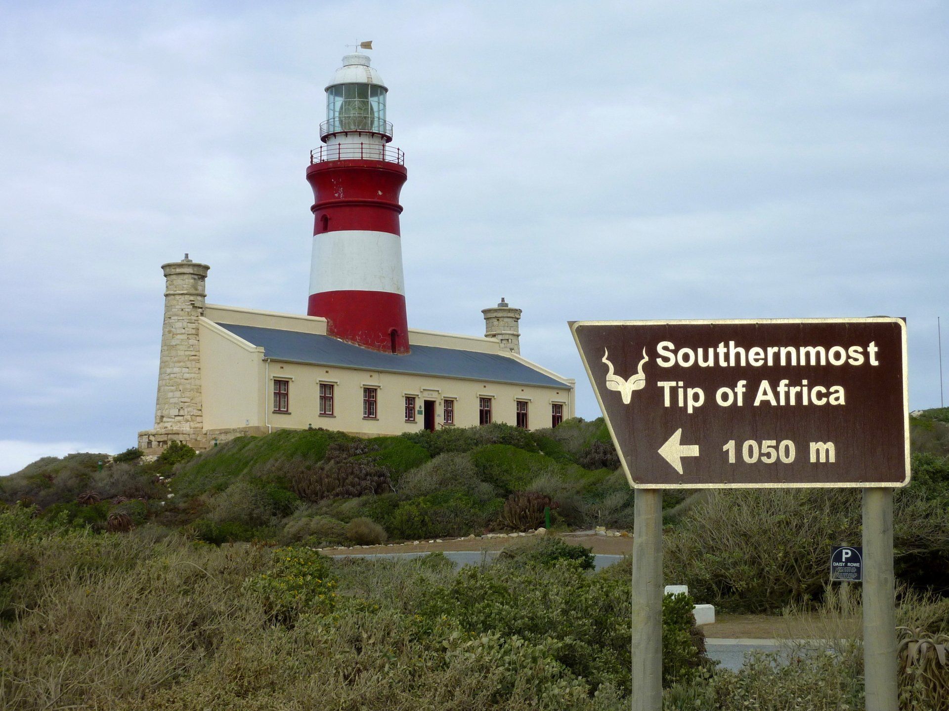
CAPE AGULHAS – AFRICA'S MOST SOUTHERN LANDMARK
Agulhas is the southernmost town in Africa and marks the spot where the Indian and Atlantic Oceans meet. Cape Agulhas was so named by Potuguese seafarers at the end of the 15th Century. Translated, it means “Cape of Needles”, referring to the needle of the compass that, at this point, shows no real deviation between true north and magnetic north. The Agulhas Lighthouse (found approximately 1 km from the point where the oceans meet) is the second olenst working lighthouse in South Africa and was erected in 1848. In 1988 it was restored to its original plan.
Slide title
Write your caption hereButton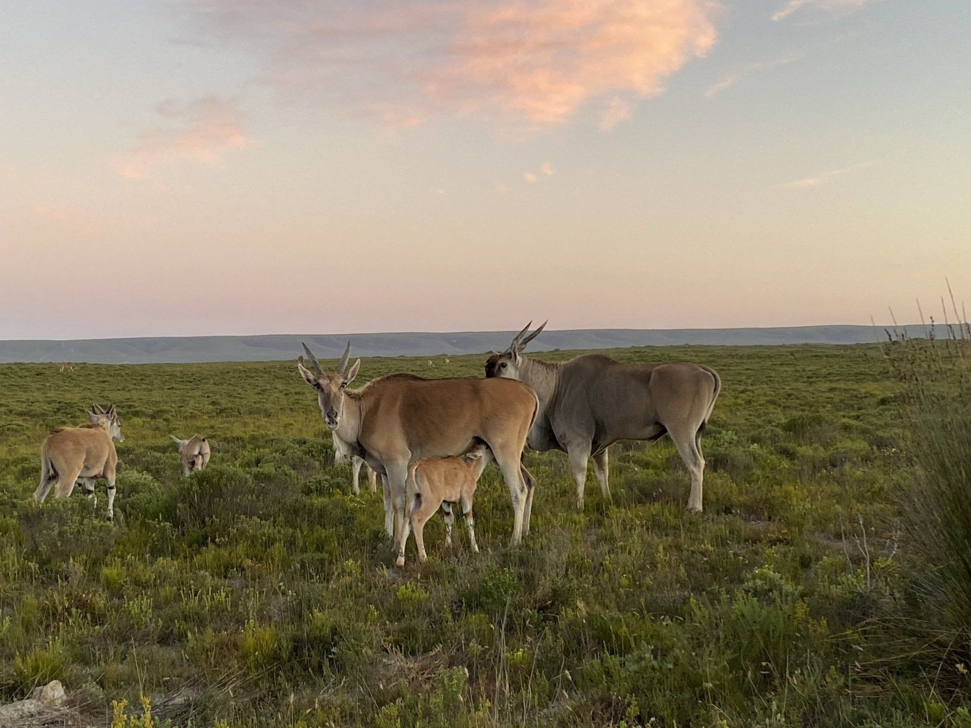
Slide title
Write your caption hereButton
DE HOOP NATURE RESERVE
De Hoop Nature Reserve lies three hours from Cape Town in the Overberg region, near Cape Agulhas, the southern tip of Africa. Approximately 340 square kilometres (130 sq mi) in area, it is one of the largest natural areas managed by Cape Nature.
De Hoop is one of the components of the "Cape Floral Region Protected Areas" World Heritage Site.
De Hoop Nature Reserve is flanked by another protected area, the De Hoop Marine Protected Area, a three nautical mile stretch.
De Hoop Nature Reserve's climate is Mediterranean, with warm summers and mild winters. The reserve gets 380 mm of rain annually. August is the wettest month. In summer, winds blow in from the east, west and southeast, whereas winter has westerly and southwesterly winds.
The vegetation De Hoop Nature Reserve is part of the world's smallest and most threatened plant kingdom, known as the Cape Floral Kingdom. The reserve also contains one of the largest areas of the rare lowland fynbos.
De Hoop is haven for both terrestrial and marine animals. Numerous species inhabit these habitats. The reserve has a total of 86 mammal species. These include the rare bontebok and Cape mountain zebra, eland, grey rhebok, baboon, yellow mongoose and caracal. Leopards, although rare, are also found in the reserve.
The waters within the De Hoop Reserve support good populations of marine mammals such as dolphins and seals. The bays of De Hoop are the breeding grounds for southern right whales. The marine protected area of the reserve has a total of 250 species of fish.
De Hoop supports a large number of resident and migratory bird species. The reserve's total bird species count is 260. Several water birds breed in the reserve. The reserve is also home to the only remaining breeding colony of the rare Cape vulture.
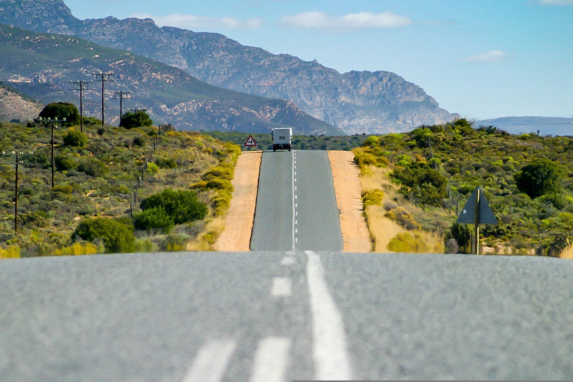
THE GARDEN ROUTE
The Garden Route spans the coastal region of the Western and Eastern Cape Provinces, stretching from Still Bay in the West, to Plettenberg Bay in the East. The route is characterised by alternating landscapes ranging from indigenous forests, to lagoons and bright sandy beaches. The mild climate, with rain falling throughout the year, ensures a lush, garden appearance all year round. It is often used as the access route to Port Elizabeth in the Eastern Cape and the malaria free game reserves further up north.
KNYSNA
Knysna is known as the "pearl" of the Garden Route. The attractiveness of the town is thanks to its geographic location. Knysna is situated on the banks of a lagoon measuring 13 square kilometres, which joins the sea through a narrow strait bordered by two shoulders of rock known as "The Heads". Water sports form the main activity on the lagoon. The area is also well known for its oysters. The area surrounding the lagoon is covered with pine forests and some indigenous forests. This scenery helps to create a tranquil setting for the picturesque town.
MOSSEL BAY
The first European to visit the bay was the Portuguese explorer Bartholomeu Dias in 1488, and he was followed by Vasco da Gama in 1497. Mossel Bay became a place where sailors stopped over in order to take on fresh water and to barter for provisions. At that time the bay was also a type of postal collection point for the sailors. “Jewel of the Garden Route”, this small well-known leisure resort is a peaceful place, where several old sandstone buildings can be found. Harbour facilities and an oil refinery have enlarged the built-up part of the bay.
PLETTENBERG BAY
Plettenberg Bay is becoming an increasingly popular holiday destination and has grown substantially in size over the last few years. The town was actually the site of the very first white "settlement" in South Africa. A Portuguese vessel was wrecked in the bay in 1630, and its crew stayed there for about 8 months. Plettenberg Bay also became a whaling station for a Norwegian company towards the middle of the 19th century. Nowadays the Bay is well known for its fine beaches and beautiful scenery.
WILDERNESS
The Wilderness National Lake Area is the first nationally proclaimed lake area in the country. The town of Wilderness is a small, quiet, seaside town, with the beach a few minutes walk away. It is situated at the mouth of the Touws River. Nowhere else is the beauty of the Garden Route and the link to nature more apparent, than in Wilderness.
WILDERNESS NATIONAL PARK
Wilderness National Park is situated in the heart of the Garden Route, South Africa. It is a fascinating combination of rivers, lakes, estuaries and beaches, unfolding against the backdrop or lush forests and imposing mountains. During spring, the area is beautifully blanketed by a kaleidoscope of colourful blossoms, further enhancing its profound beauty.
The beautiful and popular Wilderness National Park is gently nestled between the bustling towns of George and Knysna - both are exceptional tourist destinations on the Garden Route. Wilderness protects three major zones of indigenous forest, four types of Fynbos (wild shrubs), lakes and winding waterways. There are also a number of historic sites of archaeological significance.
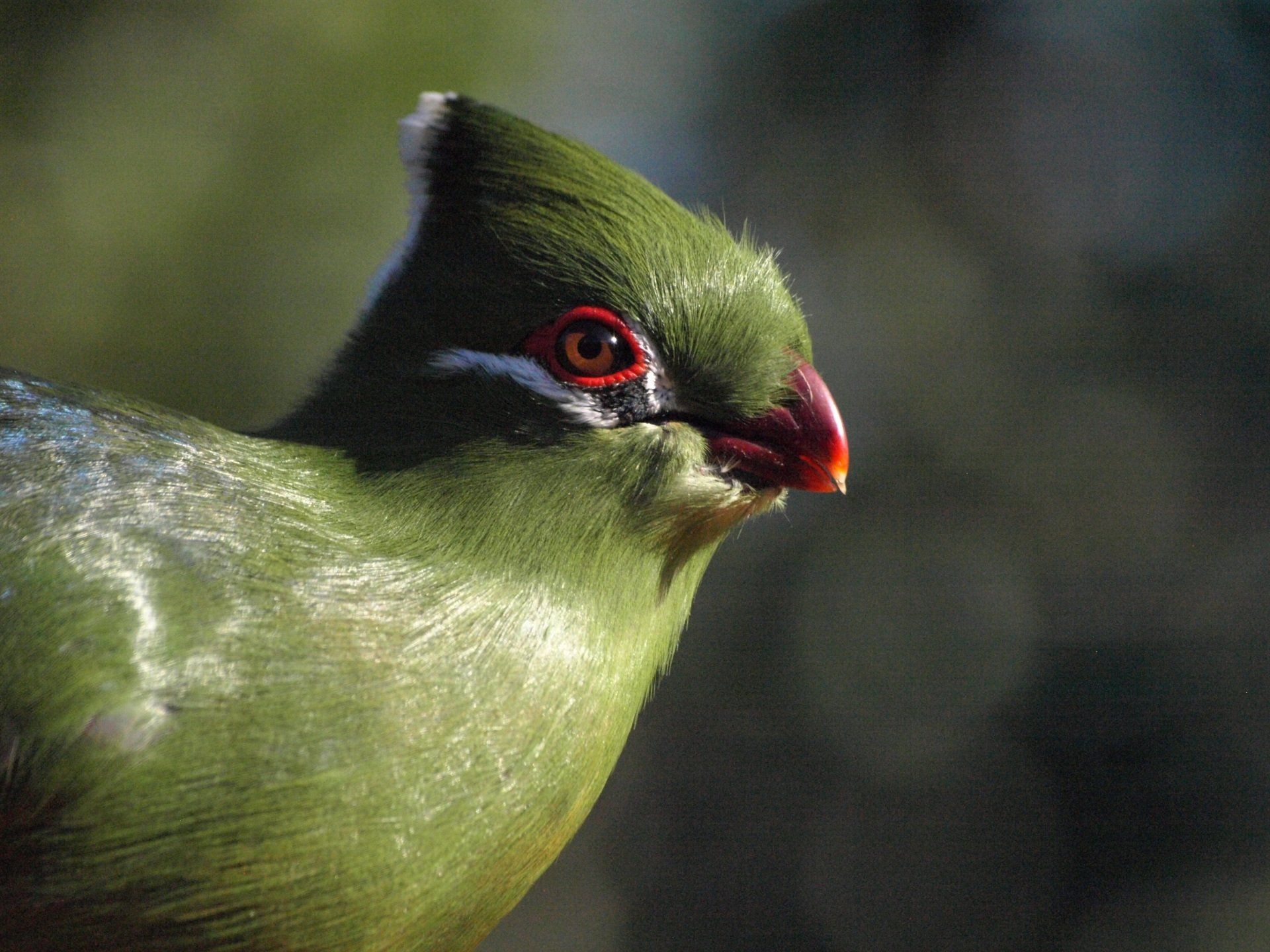
Eilandvlei, Langvlei and Rondevlei are a series of lakes connected by the Touw River. These watery havens host a variety of aquatic species and have been proclaimed as a Ramsar site (wetlands of international importance). Visitors to Wilderness can spot five types of Kingfisher, the Grey Heron and Little Egret and the brightly coloured Knysna Loerie in the forest. This area is also known for the Knysna Seahorse and Pansy Shell.
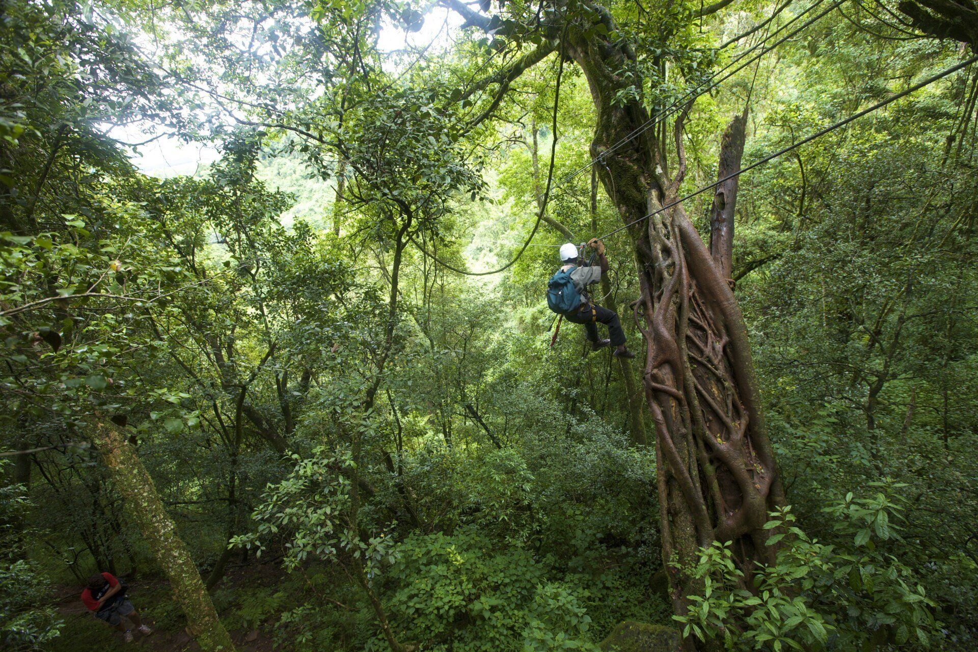
Wilderness is not only an area of natural beauty it is also an exciting playground for both young and old. Enjoy fantastic Dolphin and Whale sightings from Dolphin Point, hire a canoe or bicycle and explore the area, go abseiling, kloofing and paragliding, boating, fishing and hiking.
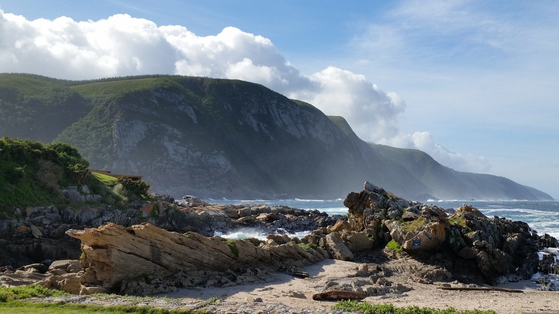
TSITSIKAMMA NATIONAL PARK
Tsitsikamma National Park is situated on a narrow strip of the southern coastline, stretching for 80 kilometres from the lagoon at Nature's Valley in the west to the mouth of the Groot River in the east. Tsitsikamma was the first marine national park in Africa. It has a diverse natural beauty, with scenery comprising white sandy beaches, dense forests and fynbos. Beautiful, indigenous, state-protected forest is home to ancient trees such as Yellowwood, Stinkwood, Hard Pear, Ironwood, Kamassi and many others. Over time, rivers have cut awesome gorges through the coastal plateau. The area is famous for its fantastic walks, and has areas that have been allocated to fishing and diving.
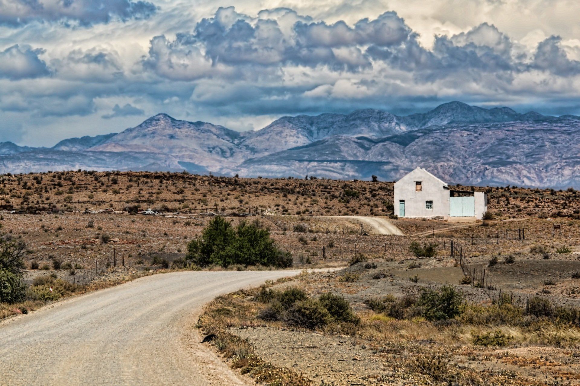
OUDTSHOORN
Oudtshoorn, the capital of the little Karoo, is a worthwhile sightseeing visit, where Dutch Reformed Churches, synagogues and the ostentatious remains of the old Ostrich farmer's estates lie. In the year 1850, South Africa was an exporter of Ostrich feathers. A few farmers in the Oudtshoorn area had the idea of forming a company, and start breeding ostriches in nearby grassy fields, where they could live naturally. To this end, an incubator was set up and put into regular use. In 1875, the district of Oudtshoorn had a total of 2.159 Ostriches. The conditions were indeed so optimal - a warm and dry climate, good quality soil, and plenty of lucern - that there was a huge boom in the Ostrich industry, and many farmers became very wealthy. Unfortunately, the First World War put an end to the success of this industry, although there are still plenty of Ostriches to be found in the district.
KNYSNA
Knysna is known as the "pearl" of the Garden Route. The attractiveness of the town is thanks to its geographic location. Knysna is situated on the banks of a lagoon measuring 13 square kilometres, which joins the sea through a narrow strait bordered by two shoulders of rock known as "The Heads". Water sports form the main activity on the lagoon. The area is also well known for its oysters. The area surrounding the lagoon is covered with pine forests and some indigenous forests. This scenery helps to create a tranquil setting for the picturesque town.
MOSSEL BAY
The first European to visit the bay was the Portuguese explorer Bartholomeu Dias in 1488, and he was followed by Vasco da Gama in 1497. Mossel Bay became a place where sailors stopped over in order to take on fresh water and to barter for provisions. At that time the bay was also a type of postal collection point for the sailors. “Jewel of the Garden Route”, this small well-known leisure resort is a peaceful place, where several old sandstone buildings can be found. Harbour facilities and an oil refinery have enlarged the built-up part of the bay.
PLETTENBERG BAY
Plettenberg Bay is becoming an increasingly popular holiday destination and has grown substantially in size over the last few years. The town was actually the site of the very first white "settlement" in South Africa. A Portuguese vessel was wrecked in the bay in 1630, and its crew stayed there for about 8 months. Plettenberg Bay also became a whaling station for a Norwegian company towards the middle of the 19th century. Nowadays the Bay is well known for its fine beaches and beautiful scenery.

WILDERNESS
The Wilderness National Lake Area is the first nationally proclaimed lake area in the country. The town of Wilderness is a small, quiet, seaside town, with the beach a few minutes walk away. It is situated at the mouth of the Touws River. Nowhere else is the beauty of the Garden Route and the link to nature more apparent, than in Wilderness.
WILDERNESS NATIONAL PARK
Wilderness National Park is situated in the heart of the Garden Route, South Africa. It is a fascinating combination of rivers, lakes, estuaries and beaches, unfolding against the backdrop or lush forests and imposing mountains. During spring, the area is beautifully blanketed by a kaleidoscope of colourful blossoms, further enhancing its profound beauty.
The beautiful and popular Wilderness National Park is gently nestled between the bustling towns of George and Knysna - both are exceptional tourist destinations on the Garden Route. Wilderness protects three major zones of indigenous forest, four types of Fynbos (wild shrubs), lakes and winding waterways. There are also a number of historic sites of archaeological significance.
Eilandvlei, Langvlei and Rondevlei are a series of lakes connected by the Touw River. These watery havens host a variety of aquatic species and have been proclaimed as a Ramsar site (wetlands of international importance). Visitors to Wilderness can spot five types of Kingfisher, the Grey Heron and Little Egret and the brightly coloured Knysna Loerie in the forest. This area is also known for the Knysna Seahorse and Pansy Shell.
Wilderness is not only an area of natural beauty it is also an exciting playground for both young and old. Enjoy fantastic Dolphin and Whale sightings from Dolphin Point, hire a canoe or bicycle and explore the area, go abseiling, kloofing and paragliding, boating, fishing and hiking.
Slide title
Write your caption hereButton
TSITSIKAMMA NATIONAL PARK
Tsitsikamma National Park is situated on a narrow strip of the southern coastline, stretching for 80 kilometres from the lagoon at Nature's Valley in the west to the mouth of the Groot River in the east. Tsitsikamma was the first marine national park in Africa. It has a diverse natural beauty, with scenery comprising white sandy beaches, dense forests and fynbos. Beautiful, indigenous, state-protected forest is home to ancient trees such as Yellowwood, Stinkwood, Hard Pear, Ironwood, Kamassi and many others. Over time, rivers have cut awesome gorges through the coastal plateau. The area is famous for its fantastic walks, and has areas that have been allocated to fishing and diving.
OUDTSHOORN
Oudtshoorn, the capital of the little Karoo, is a worthwhile sightseeing visit, where Dutch Reformed Churches, synagogues and the ostentatious remains of the old Ostrich farmer's estates lie. In the year 1850, South Africa was an exporter of Ostrich feathers. A few farmers in the Oudtshoorn area had the idea of forming a company, and start breeding ostriches in nearby grassy fields, where they could live naturally. To this end, an incubator was set up and put into regular use. In 1875, the district of Oudtshoorn had a total of 2.159 Ostriches. The conditions were indeed so optimal - a warm and dry climate, good quality soil, and plenty of lucern - that there was a huge boom in the Ostrich industry, and many farmers became very wealthy. Unfortunately, the First World War put an end to the success of this industry, although there are still plenty of Ostriches to be found in the district.
KRUGER NATIONAL PARK
KRUGER NATIONAL PARK
Until the arrival of “Westernised men” in the late 19th century, the area covered by the Kruger Park probably looked much like it does now, vast and relatively undisturbed. In the 19th century, farmers settled and white hunters brought their formidable firepower to bear on the herds, taking a devastating toll on the buffalo, wildebeest and other species. The situation worsened during the Anglo-Boer war as the English hunted to supplement rations and the hungry black population scoured the countryside for food. It was in May 1926 that this enormous slice of territory was formally proclaimed a National Park and named in honour of Paul Kruger, who gave impetus to the creation of wildlife sanctuaries in the 1890s.
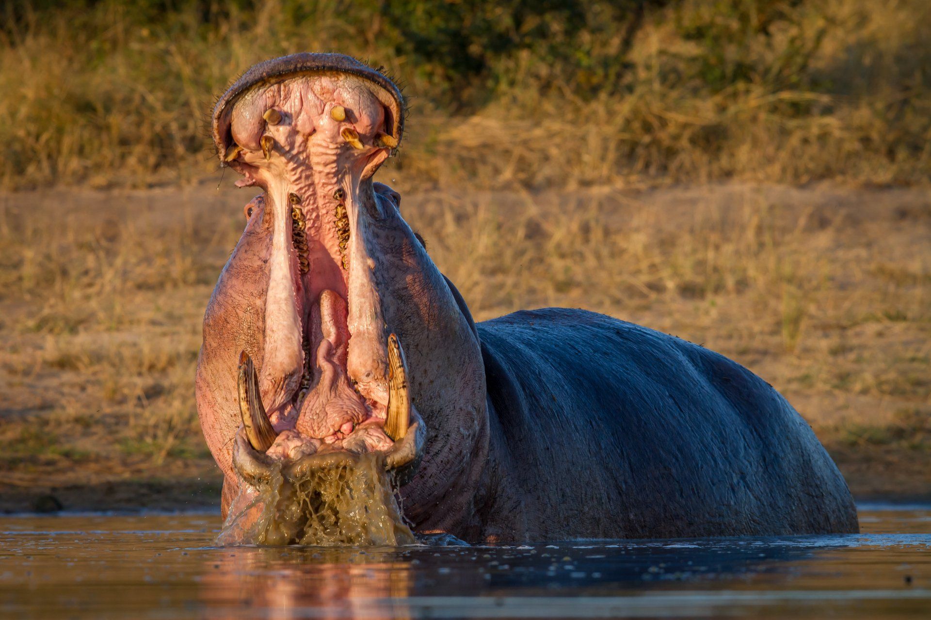
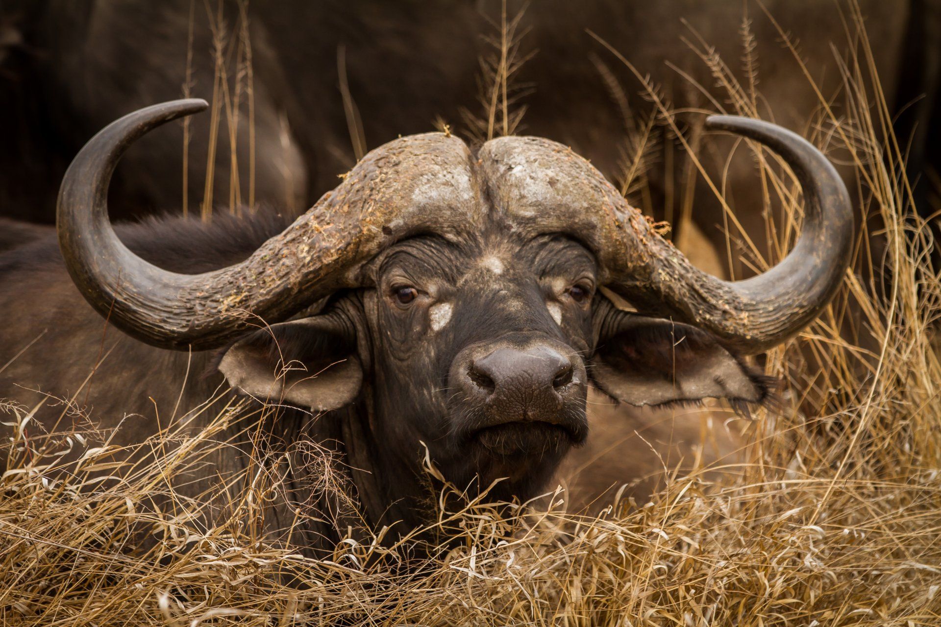
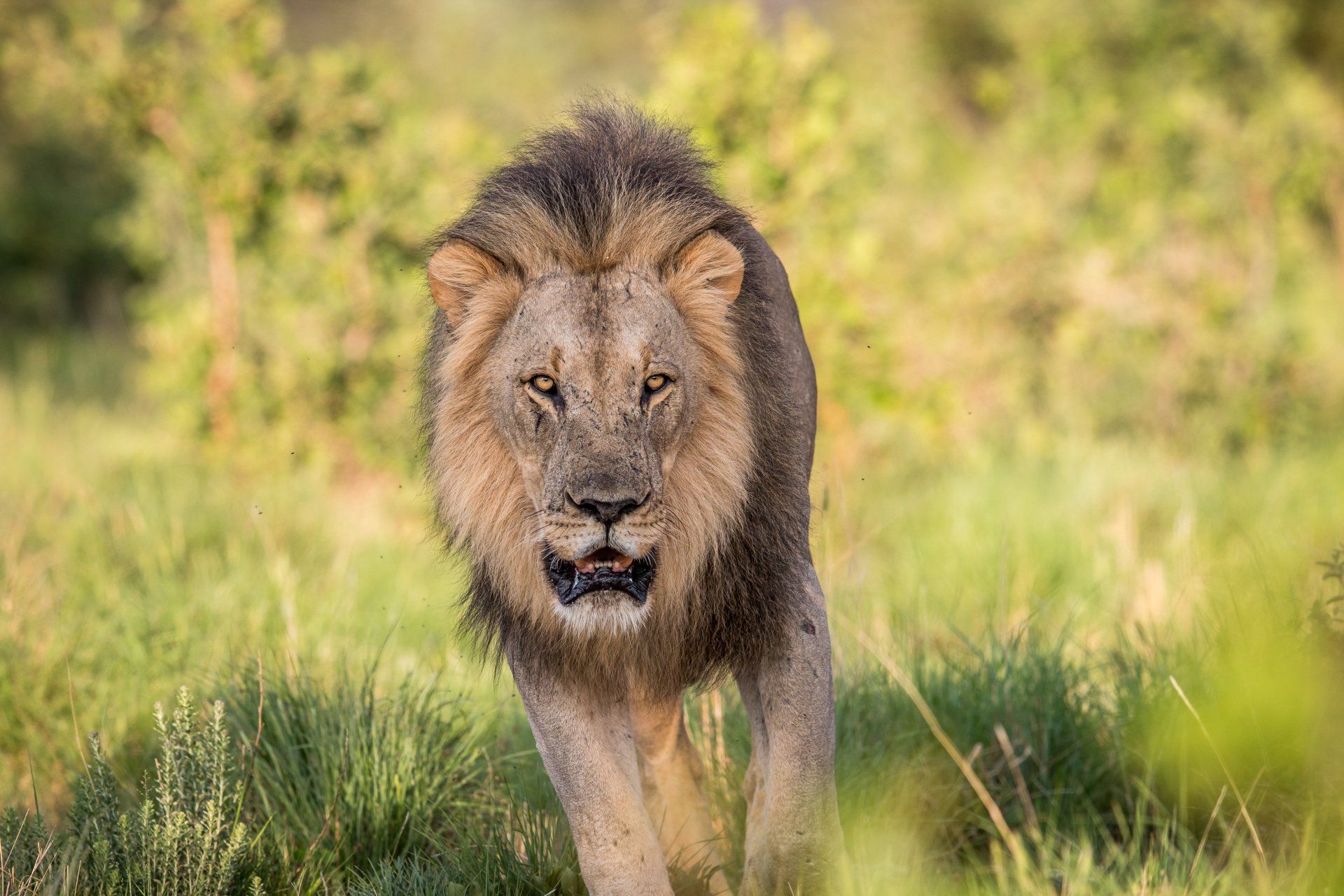
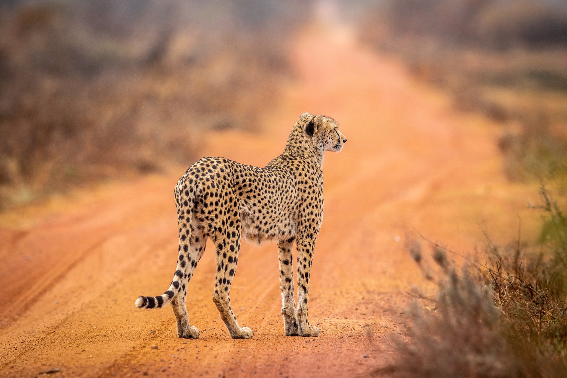
Majestic in extent, rich in game, grand in its scenic splendour, the Kruger National Park is now the pride of South Africa. With an almost 2,000,000 hectare expanse of savannah and bush, the Kruger Park is big game country. Lion, elephant, buffalo, rhino and tens of thousands of antelope roam the sunlit plains. Leopards stalk during the night; shy bushbuck hide in the riverine bush; giraffe browse on the sweet-scented acacias and vultures wheel overhead, alert for kills and carcass. The Park counts 137 mammal species, about 500 bird species and more than 100 reptile varieties.
THE GREATER KRUGER NATIONAL PARK
The ‘Greater Kruger’ refers to 344,000 hectares (860,000 acres) of protected land to the west of Kruger National Park that provides a more substantial area for wildlife to roam freely. Private and local community property owners own this additional land, and most is utilised for commercial purposes.
There are no longer fences between these properties and KNP, providing the animals with an opportunity to roam, thereby reducing pressure on vegetation and bringing back historical local seasonal wildlife movements. Historically most seasonal migration was in an east-west direction, from the coastal areas of Mozambique to the slopes of the Drakensberg mountains, to take advantage of seasonal food and water. Fences and human pressure now prohibit that movement, and the north-south shape of KNP is not optimal for seasonal migrations.
To this vast area there are a number of famous private game reserve such as: Sabi Sands Private Nature Reserve, Balule Private Game Reserve, Timbavati game Reserve, Klaserie Nature Reserve, Manyeleti Game Reserve and Thornybush Game Reserve.
To avoid the crowd...there are private concession in the Kruger National Park. These are vast areas which are privately run and where the general public has no access.
KRUGER NATIONAL PARK
Until the arrival of “Westernised men” in the late 19th century, the area covered by the Kruger Park probably looked much like it does now, vast and relatively undisturbed. In the 19th century, farmers settled and white hunters brought their formidable firepower to bear on the herds, taking a devastating toll on the buffalo, wildebeest and other species. The situation worsened during the Anglo-Boer war as the English hunted to supplement rations and the hungry black population scoured the countryside for food. It was in May 1926 that this enormous slice of territory was formally proclaimed a National Park and named in honour of Paul Kruger, who gave impetus to the creation of wildlife sanctuaries in the 1890s.
Majestic in extent, rich in game, grand in its scenic splendour, the Kruger National Park is now the pride of South Africa. With an almost 2,000,000 hectare expanse of savannah and bush, the Kruger Park is big game country. Lion, elephant, buffalo, rhino and tens of thousands of antelope roam the sunlit plains. Leopards stalk during the night; shy bushbuck hide in the riverine bush; giraffe browse on the sweet-scented acacias and vultures wheel overhead, alert for kills and carcass. The Park counts 137 mammal species, about 500 bird species and more than 100 reptile varieties.
THE GREATER KRUGER NATIONAL PARK
The ‘Greater Kruger’ refers to 344,000 hectares (860,000 acres) of protected land to the west of Kruger National Park that provides a more substantial area for wildlife to roam freely. Private and local community property owners own this additional land, and most is utilised for commercial purposes.
There are no longer fences between these properties and KNP, providing the animals with an opportunity to roam, thereby reducing pressure on vegetation and bringing back historical local seasonal wildlife movements. Historically most seasonal migration was in an east-west direction, from the coastal areas of Mozambique to the slopes of the Drakensberg mountains, to take advantage of seasonal food and water. Fences and human pressure now prohibit that movement, and the north-south shape of KNP is not optimal for seasonal migrations.
To this vast area there are a number of famous private game reserve such as: Sabi Sands Private Nature Reserve, Balule Private Game Reserve, Timbavati game Reserve, Klaserie Nature Reserve, Manyeleti Game Reserve and Thornybush Game Reserve.
To avoid the crowd...there are private concession in the Kruger National Park. These are vast areas which are privately run and where the general public has no access.
PANORAMA ROUTE
Slide title
Write your caption hereButton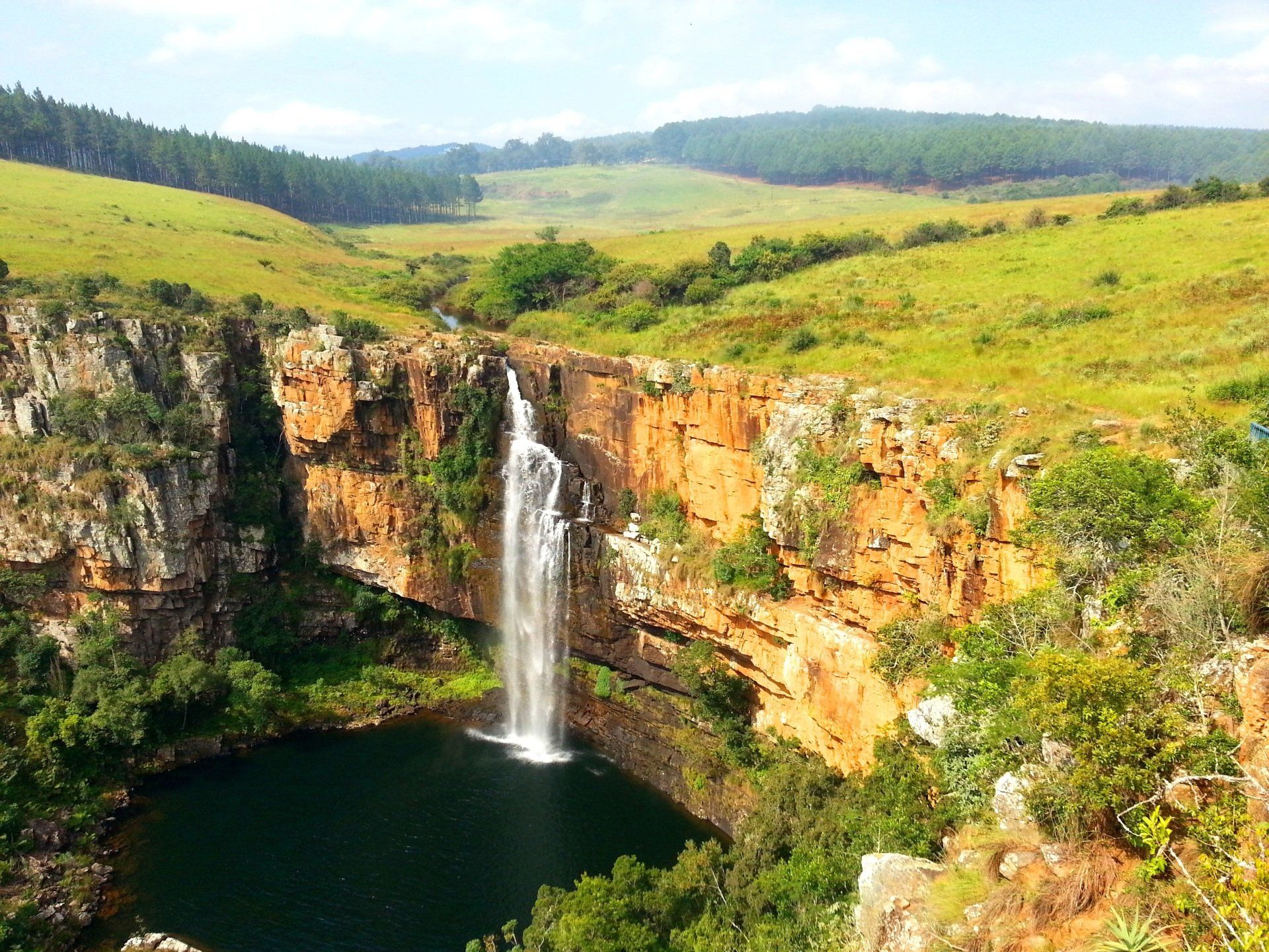
Slide title
Write your caption hereButton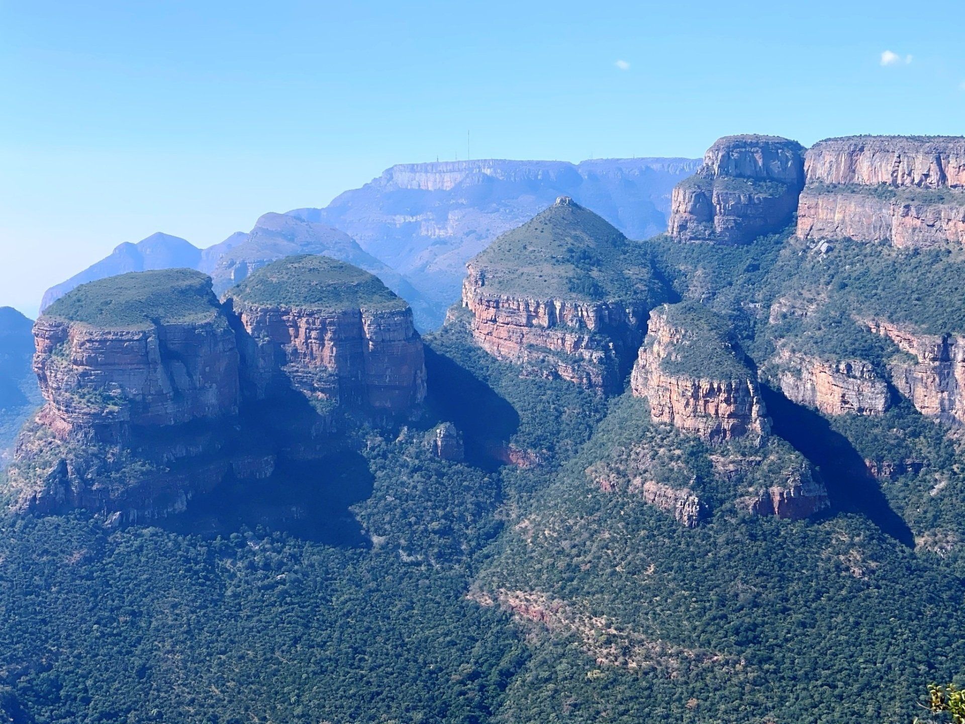
Slide title
Write your caption hereButton
MPUMULANGA DRAKENSBERG
The northern section of the Drakensberg Mountains stretches through the province of Mpumalanga. The road that joins the towns of Sabie and Graskop constitutes the spectacular Panoramic Route through the Blyde River Canyon section of the Drakensberg.
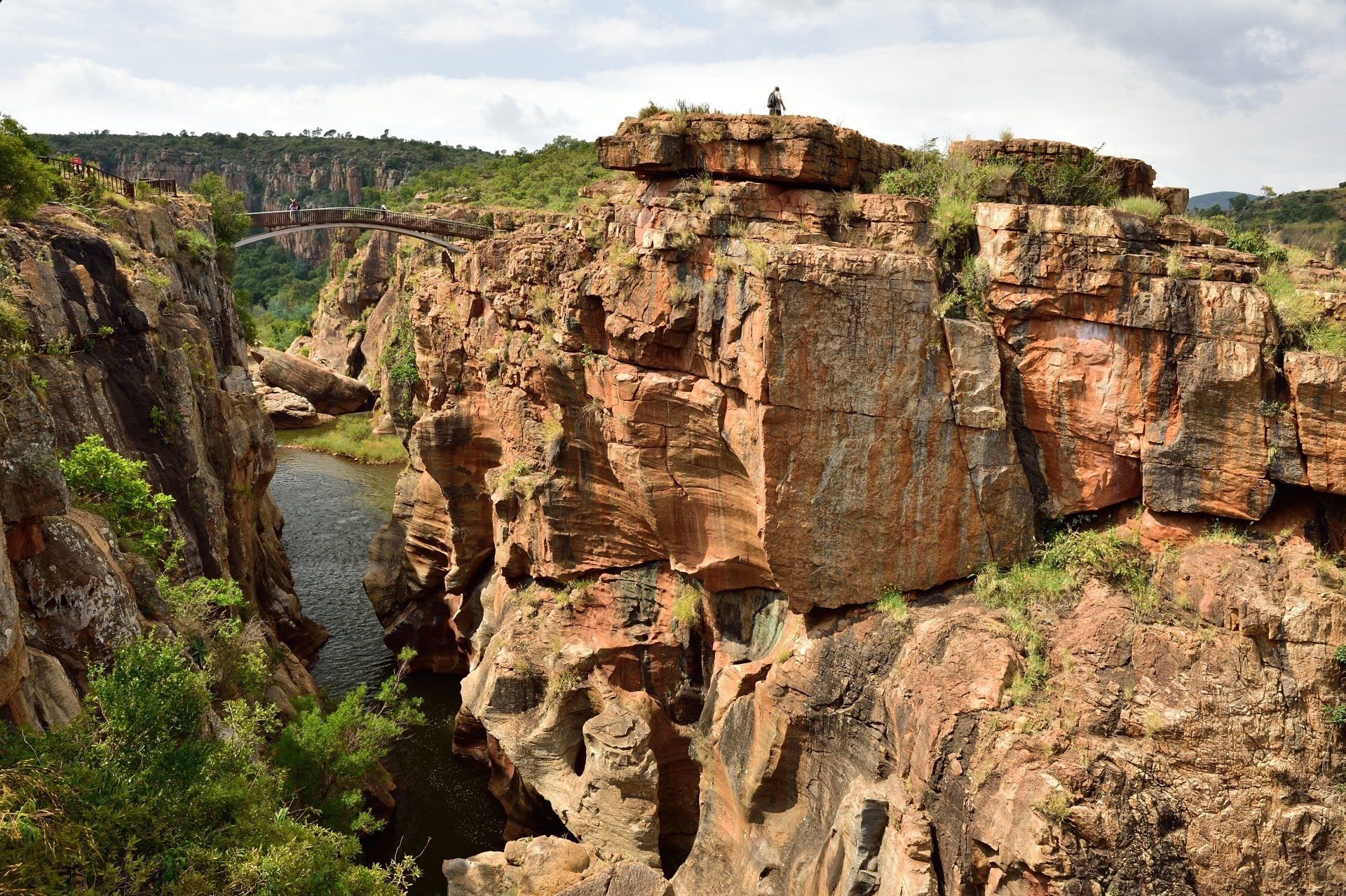
After the Grand Canyon in the United States and the Fish River Canyon in Namibia, the 30 kilometre long Blyde River Canyon occupies third place on the world’s list of canyons and is one of the most impressive natural phenomena in South Africa. The canyon is dominated by three similarly shaped peaks (the Three Rondavels) and by Mariepskop (the highest point of this section of the Drakensberg Mountain Range). The road continues through a rugged landscape where fruit, vegetables and tobacco are grown in reddish soil before entering Pilgrim’s Rest.
The Pinnacle, Jock’s View, God’s Window and Wonderview are some of the most famous scenic lookouts where a stop is highly recommended. These stops offer lookouts over sheer cliffs and unique geologic features over the expanse of the Lowveld. Further north are Lisbon Falls and the Berlin Falls, just before reaching Bourke’s Luck Potholes. Here, paths and footbridges take visitors to viewing sites overlooking extraordinary samples of river erosion. Northwards, the Blyde River has carved a magnificent gorge through the mountains.
-
Slide title
Write your caption hereButton -
Slide title
Write your caption hereButton -
Slide title
Write your caption hereButton
MPUMULANGA DRAKENSBERG
The northern section of the Drakensberg Mountains stretches through the province of Mpumalanga. The road that joins the towns of Sabie and Graskop constitutes the spectacular Panoramic Route through the Blyde River Canyon section of the Drakensberg.
After the Grand Canyon in the United States and the Fish River Canyon in Namibia, the 30 kilometre long Blyde River Canyon occupies third place on the world’s list of canyons and is one of the most impressive natural phenomena in South Africa. The canyon is dominated by three similarly shaped peaks (the Three Rondavels) and by Mariepskop (the highest point of this section of the Drakensberg Mountain Range). The road continues through a rugged landscape where fruit, vegetables and tobacco are grown in reddish soil before entering Pilgrim’s Rest.
The Pinnacle, Jock’s View, God’s Window and Wonderview are some of the most famous scenic lookouts where a stop is highly recommended. These stops offer lookouts over sheer cliffs and unique geologic features over the expanse of the Lowveld. Further north are Lisbon Falls and the Berlin Falls, just before reaching Bourke’s Luck Potholes. Here, paths and footbridges take visitors to viewing sites overlooking extraordinary samples of river erosion. Northwards, the Blyde River has carved a magnificent gorge through the mountains.
MADIKWE GAME RESERVE
Slide title
Write your caption hereButton
Slide title
Write your caption hereButton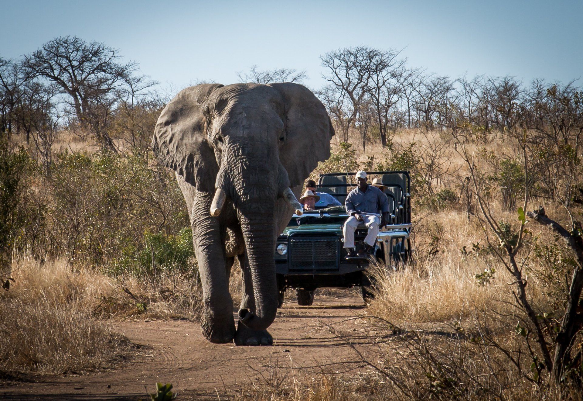
Slide title
Write your caption hereButton
MADIKWE GAME RESERVE
The northern section of the Drakensberg Mountains stretches through the province of Mpumalanga. The road that joins the towns of Sabie and Graskop constitutes the spectacular Panoramic Route through the Blyde River Canyon section of the Drakensberg.
After the Grand Canyon in the United States and the Fish River Canyon in Namibia, the 30 kilometre long Blyde River Canyon occupies third place on the world’s list of canyons and is one of the most impressive natural phenomena in South Africa. The canyon is dominated by three similarly shaped peaks (the Three Rondavels) and by Mariepskop (the highest point of this section of the Drakensberg Mountain Range). The road continues through a rugged landscape where fruit, vegetables and tobacco are grown in reddish soil before entering Pilgrim’s Rest.
The Pinnacle, Jock’s View, God’s Window and Wonderview are some of the most famous scenic lookouts where a stop is highly recommended. These stops offer lookouts over sheer cliffs and unique geologic features over the expanse of the Lowveld. Further north are Lisbon Falls and the Berlin Falls, just before reaching Bourke’s Luck Potholes. Here, paths and footbridges take visitors to viewing sites overlooking extraordinary samples of river erosion. Northwards, the Blyde River has carved a magnificent gorge through the mountains.
-
Slide title
Write your caption hereButton -
Slide title
Write your caption hereButton -
Slide title
Write your caption hereButton
MADIKWE GAME RESERVE
The northern section of the Drakensberg Mountains stretches through the province of Mpumalanga. The road that joins the towns of Sabie and Graskop constitutes the spectacular Panoramic Route through the Blyde River Canyon section of the Drakensberg.
After the Grand Canyon in the United States and the Fish River Canyon in Namibia, the 30 kilometre long Blyde River Canyon occupies third place on the world’s list of canyons and is one of the most impressive natural phenomena in South Africa. The canyon is dominated by three similarly shaped peaks (the Three Rondavels) and by Mariepskop (the highest point of this section of the Drakensberg Mountain Range). The road continues through a rugged landscape where fruit, vegetables and tobacco are grown in reddish soil before entering Pilgrim’s Rest.
The Pinnacle, Jock’s View, God’s Window and Wonderview are some of the most famous scenic lookouts where a stop is highly recommended. These stops offer lookouts over sheer cliffs and unique geologic features over the expanse of the Lowveld. Further north are Lisbon Falls and the Berlin Falls, just before reaching Bourke’s Luck Potholes. Here, paths and footbridges take visitors to viewing sites overlooking extraordinary samples of river erosion. Northwards, the Blyde River has carved a magnificent gorge through the mountains.
WATERBERG REGION
The Waterberg mountain range stretches over 150 km in a wide arc from Thabazimbi to Mokopane (formerly Potgietersrus) in the south-west of Limpopo Province. The highest elevation is the 2100m high Kransberg near Thabazimbi.
In this area there are a number of animal and nature reserve areas, some with camps and lodges. About 75 species of mammals including the Big Five live here, as well as numerous species of birds.
The Waterberg region is considered South Africa's best kept secret. The rugged beauty of the mountains, the vast bushland criss-crossed by rivers and the savannah, the wealth of animals and plants make this part of South Africa particularly impressive.
Slide title
Write your caption hereButton
WELGEVONDEN PRIVATE GAME RESERVE
Welgevonden is situated in South Africa’s Limpopo Province and is about a 2½-hour drive from Johannesburg. It is adjacent to the Marakele National Park with future plans to drop fences between these properties in order to extend the access to wildlife. Covering an area of 33,000 hectares, this reserve offers habitats for a variety of flora and fauna including elephant, lion, leopard, rhinoceros, giraffe and many antelope species as well as an abundance of birds. Landscapes in this region are spectacular, due in large part to the presence of the Waterberg Mountains. The accommodation facilities available at Welgevonden have exclusive rights to traverse in this reserve.
MARAKELE NATIONAL PARK
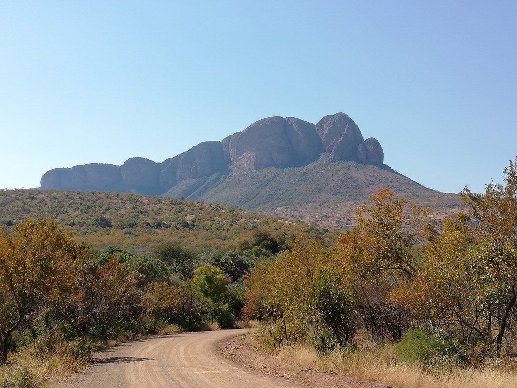
A game rich nature reserve characterised by the contrast of imposing mountain landscapes, deep valleys and grass-clad hills.
Located just 4 hours from Gauteng and 3 hours from Tshwane on the south-western corner of the Limpopo province in South Africa, the Marakele National Park is home to an impressive array of African wildlife including the Big 5 of the animal kingdom as well as wild dog, spotted hyaenas and giraffe. Originally established as the Kransberg National Park in 1994 the nature park was later given its Tswana name; a 'place of sanctuary' when its borders were expanded.
-
Slide title
Write your caption hereButton
WELGEVONDEN PRIVATE GAME RESERVE
Welgevonden is situated in South Africa’s Limpopo Province and is about a 2½-hour drive from Johannesburg. It is adjacent to the Marakele National Park with future plans to drop fences between these properties in order to extend the access to wildlife. Covering an area of 33,000 hectares, this reserve offers habitats for a variety of flora and fauna including elephant, lion, leopard, rhinoceros, giraffe and many antelope species as well as an abundance of birds. Landscapes in this region are spectacular, due in large part to the presence of the Waterberg Mountains. The accommodation facilities available at Welgevonden have exclusive rights to traverse in this reserve.
MARAKELE NATIONAL PARK
A game rich nature reserve characterised by the contrast of imposing mountain landscapes, deep valleys and grass-clad hills.
Located just 4 hours from Gauteng and 3 hours from Tshwane on the south-western corner of the Limpopo province in South Africa, the Marakele National Park is home to an impressive array of African wildlife including the Big 5 of the animal kingdom as well as wild dog, spotted hyaenas and giraffe. Originally established as the Kransberg National Park in 1994 the nature park was later given its Tswana name; a 'place of sanctuary' when its borders were expanded.
KWA-ZULU NATAL
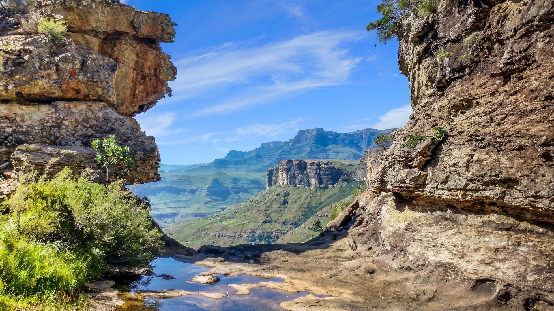
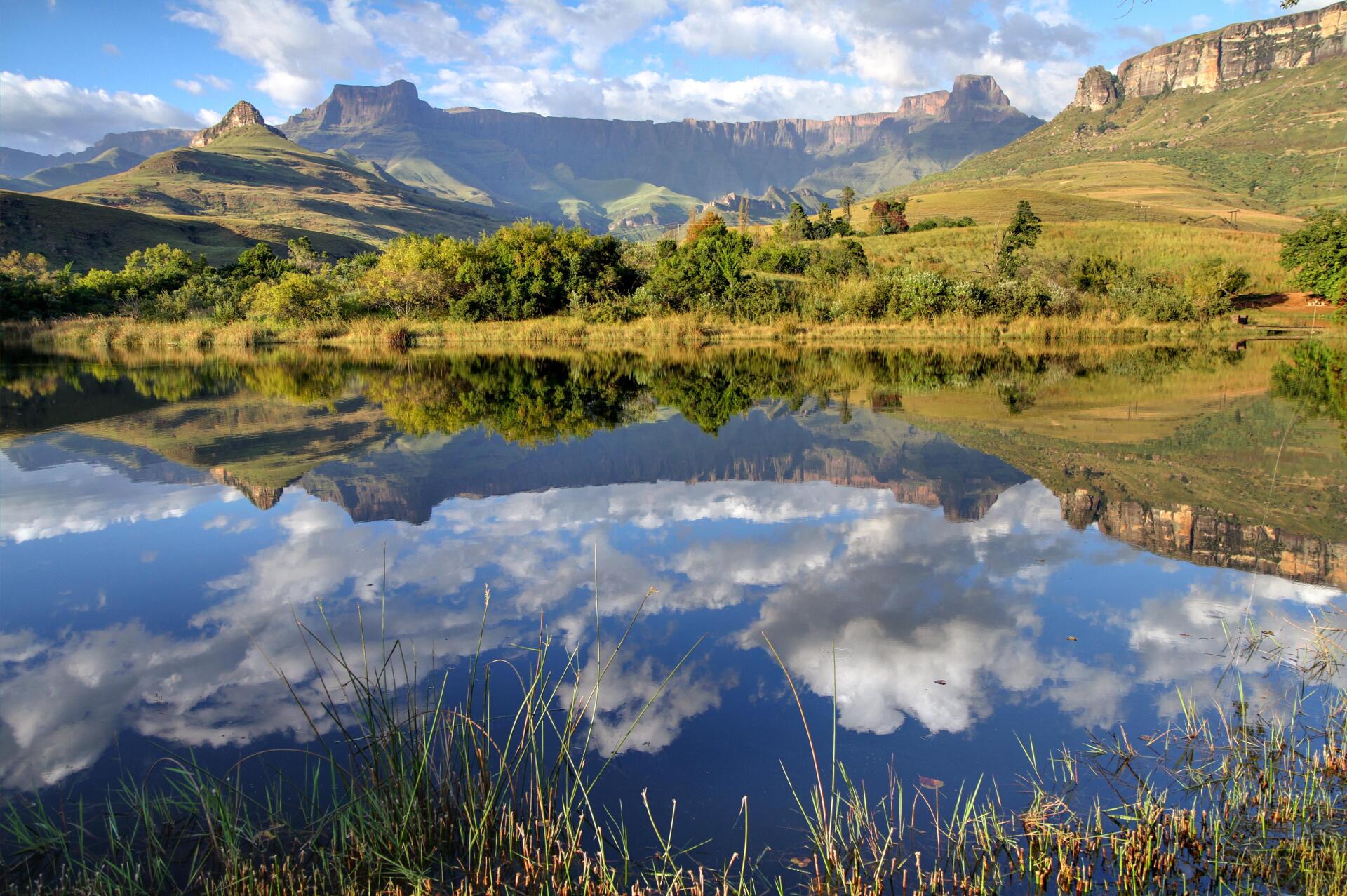
UKHAHLAMBA DRAKENSBERG PARK
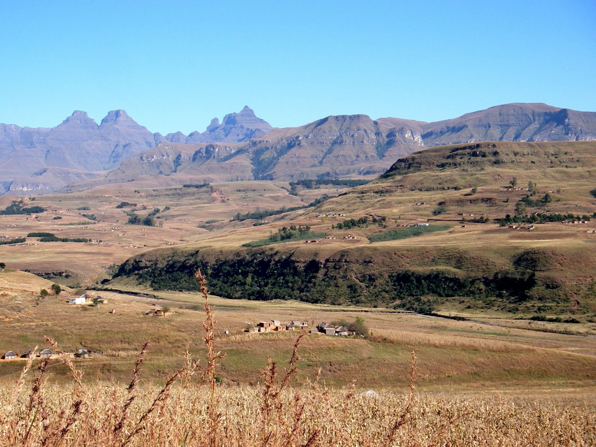
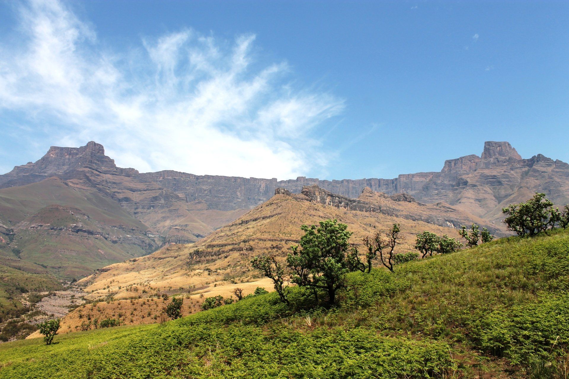
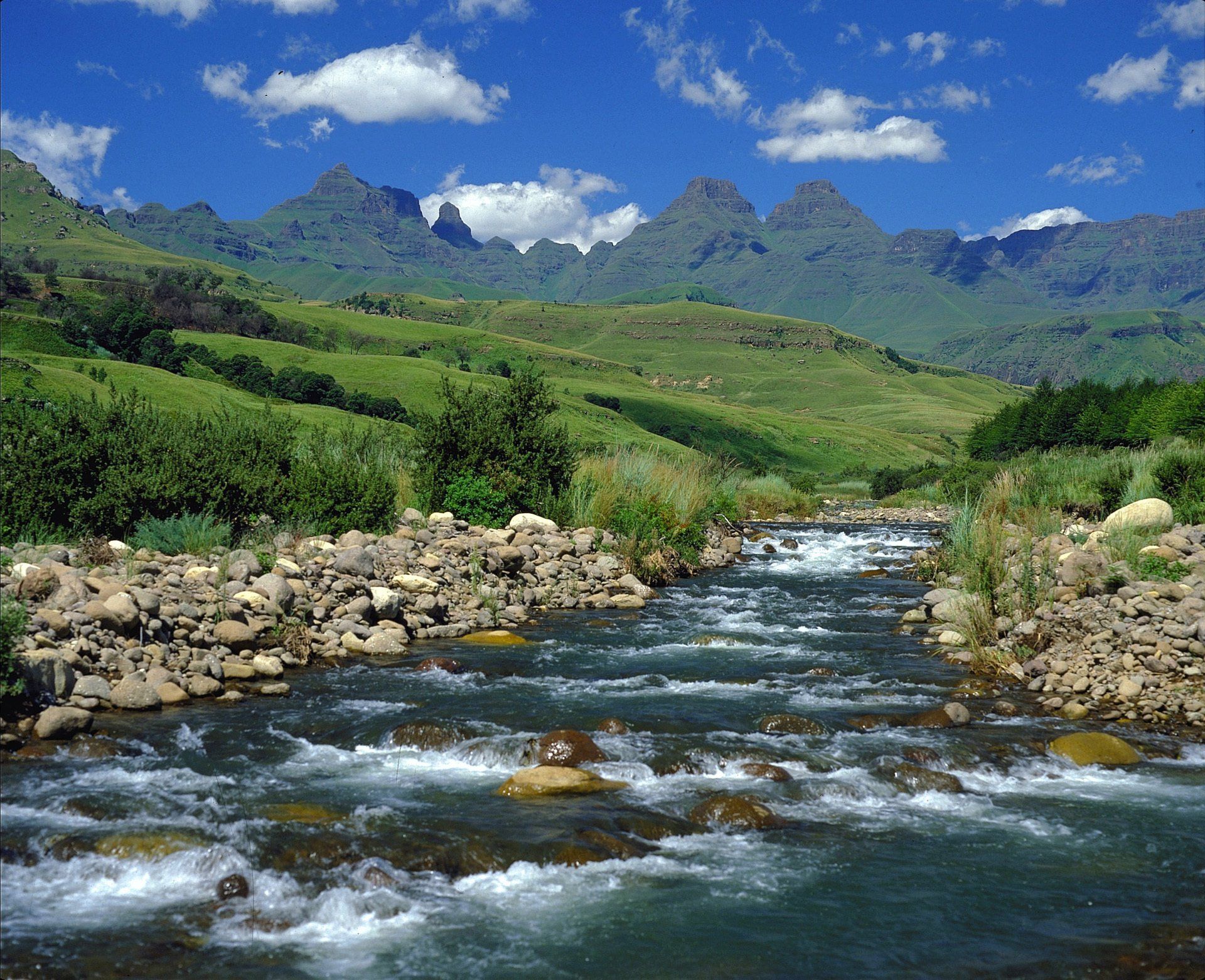
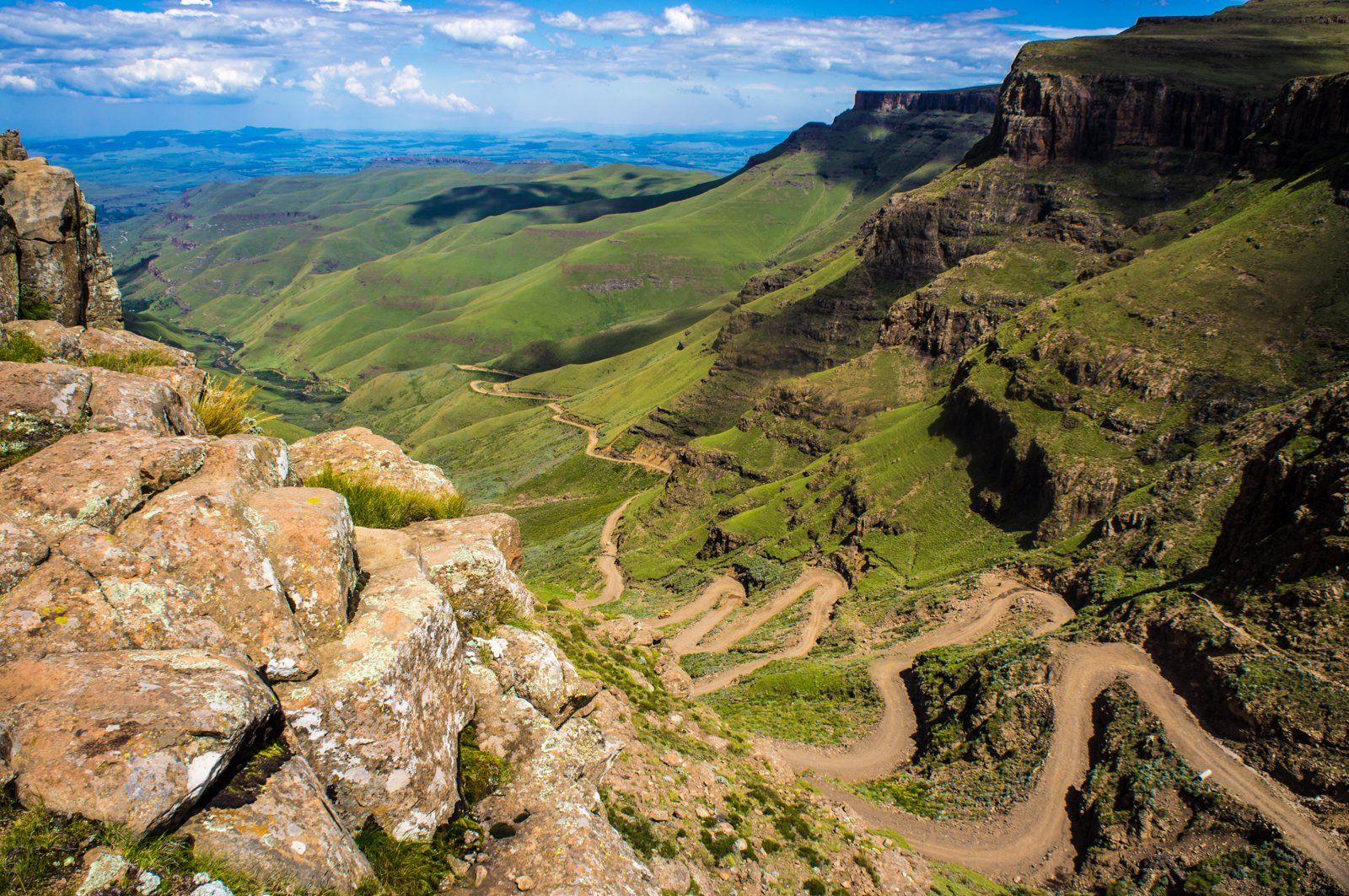
Standing on top of the world in the Ukhahlamba Drakensberg Park, surrounded by craggy peaks, sandstone cliffs, cascading waterfalls, crystal streams, rocky paths, caves and sweeping grasslands, you can salute the sunrise with the world at your feet. Ukhahlamba Drakensberg Park, now a World Heritage Site and one of South Africa’s premier eco-tourism destinations, provides an awe inspiring arena of mountains and clean air where one can savour the uncluttered freedom that only great open spaces provide. The attractions of these mountains, which rise to altitudes exceeding 3,000 metres, are astonishing. The soaring grandeur of the world-famous Amphitheatre at Royal Natal National Park where a great rampart of rocks seems to touch the sky, the tranquility and scenic splendour of the southern Drakensberg at Cobham and Loteni and the San rock art which richly decorates more than 500 coves throughout the mountains giving testament to a vanished people are just some of the attractions. The opportunity to watch the bearded vulture feed at Giant’s Castle or to witness the stately walk of the massive eland antelope as they forage the grassy slopes of the foothills and to witness the floral splendour are memories of this magnificent place which you will carry with you forever.
HLUHLUWE-IMFOLOZI PARK
Hluhluwe-Imfolozi Park is a natural treasure trove of fascinating fauna and flora, with species including lion, leopard, elephant, buffalo, black and white rhino, cheetah, hyena, African wild dog and a wide variety of antelope species and many others. Over 300 bird species have been recorded. A number of picnic sites are scattered at key points around the park, and three self-guided walks with magnificent views can be enjoyed by visitors. Guided walks into “Big 5” country are also available on a daily basis. Imfolozi lies in the heart of the Zulu Kingdom, where ancient trails lead through the thornveld and along the mighty rivers of Africa’s oldest established Wilderness area. Once the exclusive royal hunting ground of King Shaka, this rich tapestry of natural and cultural history still beats with the rhythms of Africa. “Operation White Rhino” in the 1950’s won the park world recognition for its white rhino conservation and its specialist Game Capture Unit. Imfolozi is also well known for the four-day Wilderness walking trails, which began around the same time. The Hluhluwe section in the north is characterised by towering grassland hills and diverse terrain and vegetation and is exceptional for its rich variety of bird and animal life. Open-vehicle safaris, self-guided auto trails, morning and afternoon guided walks in the big-game country and boat cruises on the Hluhluwe dam are some of the activities offered.
BATTLEFIELDS
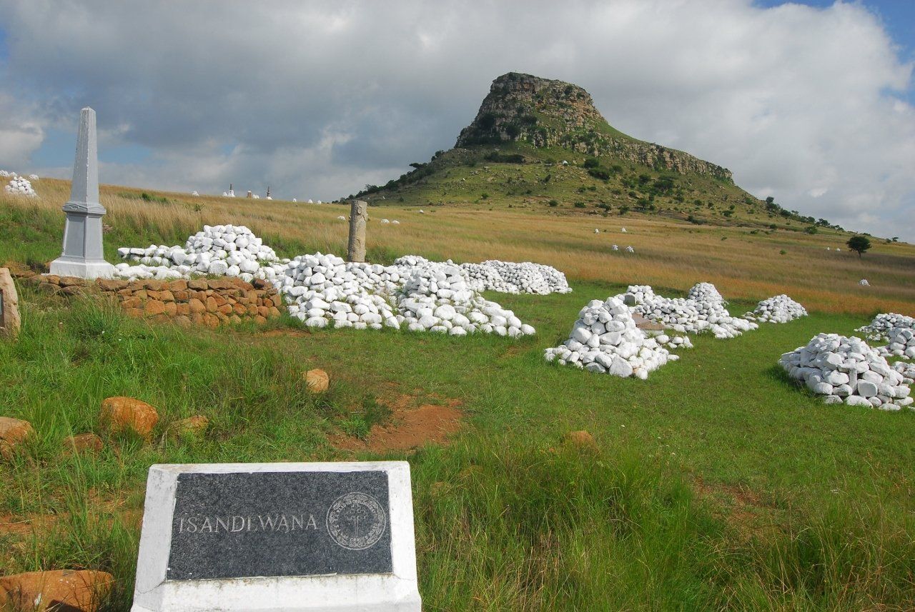
The Midlands were the site of some of South Africa's most significant battles, extending over more than 200 turbulent years. It was here that the Voortrekkers were confronted by Zulu armies, and where the mighty British army was defeated by the power of the Zulu nation. The battlefields area is also famous for the successful resistance of the Afrikaner nation of the threat of British imperial colonisation during the Anglo-Boer Wars. Near Dundee, the following are among the most important battlefields:- Blood River Battlefield: In December 1838, the Voortrekkers defeated a Zulu army here. Isandlwana Battlefield: In January 1879, a British regiment was annihilated on this site by an army of 25 000 Zulus. Rorkes Drift Battlefield: In January 1879, 100 British soldiers won a 12-hour battle against overwhelming Zulu odds. Talana Battlefield: In October 1899 is the scene of the first battle of the Anglo-Boer War.
ELEPHANT COAST
A land of lakes and sunshine, of golden dunes and mysterious swamps is located in the north of KwaZulu Natal. Bound by the rugged gorges and ravines of the Lubombo Mountains in the west, Mozambique to the north and the Indian Ocean to the south, these 900,000 hectares of wilderness are an enormous fragile land of contrasts, palms, pelicans and hippos. It is a transition zone between the tropics and subtropical KwaZulu Natal and has 21 different ecosystems. The region includes three huge lakes (St Lucia, Sibayi and Nhlange), the Tembe Elephant Park, Fomothini Pan, swamps, Ndumo and Mkuzi game reserves, the wide Pongola floodplain (dotted with one waterfowl-crowded pan after another) and the beautiful St Lucia complex. The Elephant Coast deserves to be classed with the biggest of southern Africa’s wild areas such as Kruger, the Okavango Delta, the Central Kalahari and Hwange).
iSIMANGALISO WETLAND PARK
The iSimangaliso Wetland Park consists of a number of smaller parks and resorts, state forests and nature reserves as well as lakes, islands and estuaries constituting an area of 38,000 hectares, and straddles both subtropical and tropical climatic zones. It stretches from just south of the St Lucia Estuary to the far border of the Kosi Bay Nature Reserve. The vegetation and wildlife are very diverse - five ecosystems make up the entire area and include grasslands, forests, wetlands, mangrove and vegetated dunes as well as beaches and coral reefs. The Park has been recognised as a World Heritage Site and has been registered as a Wetlands of International Significance under the Ramsar Convention.
Ecosystem
The swampland is a saltwater system that exists out of 5 separate eco-systems. The systems function independently from each other and are fully integrated with one another. The 5 eco-systems in the park are:
- The marine system – the warm Indian Ocean with the most southerly coral reefs in Africa, underground valleys and long sandy beaches.
- The eastern coast – a system with high straight dunes and subtropical forest, grassland and swampland.
- The lake system – including the estuary connected with the lakes at St. Lucia, Kosi Bay and four large fresh water lakes from Sibaya, Ngobezeleni, North-Bhangazi and South Bhangazi.
- The Mkuze and Umfolozi swamps – with swamp forest and large swamps of reets and payrus.
- The western Coastline – including ancient terrace and dry savannah forest.
UKHAHLAMBA DRAKENSBERG PARK
Standing on top of the world in the Ukhahlamba Drakensberg Park, surrounded by craggy peaks, sandstone cliffs, cascading waterfalls, crystal streams, rocky paths, caves and sweeping grasslands, you can salute the sunrise with the world at your feet. Ukhahlamba Drakensberg Park, now a World Heritage Site and one of South Africa’s premier eco-tourism destinations, provides an awe inspiring arena of mountains and clean air where one can savour the uncluttered freedom that only great open spaces provide. The attractions of these mountains, which rise to altitudes exceeding 3,000 metres, are astonishing. The soaring grandeur of the world-famous Amphitheatre at Royal Natal National Park where a great rampart of rocks seems to touch the sky, the tranquility and scenic splendour of the southern Drakensberg at Cobham and Loteni and the San rock art which richly decorates more than 500 coves throughout the mountains giving testament to a vanished people are just some of the attractions. The opportunity to watch the bearded vulture feed at Giant’s Castle or to witness the stately walk of the massive eland antelope as they forage the grassy slopes of the foothills and to witness the floral splendour are memories of this magnificent place which you will carry with you forever.
HLUHLUWE-IMFOLOZI PARK
Hluhluwe-Imfolozi Park is a natural treasure trove of fascinating fauna and flora, with species including lion, leopard, elephant, buffalo, black and white rhino, cheetah, hyena, African wild dog and a wide variety of antelope species and many others. Over 300 bird species have been recorded. A number of picnic sites are scattered at key points around the park, and three self-guided walks with magnificent views can be enjoyed by visitors. Guided walks into “Big 5” country are also available on a daily basis. Imfolozi lies in the heart of the Zulu Kingdom, where ancient trails lead through the thornveld and along the mighty rivers of Africa’s oldest established Wilderness area. Once the exclusive royal hunting ground of King Shaka, this rich tapestry of natural and cultural history still beats with the rhythms of Africa. “Operation White Rhino” in the 1950’s won the park world recognition for its white rhino conservation and its specialist Game Capture Unit. Imfolozi is also well known for the four-day Wilderness walking trails, which began around the same time. The Hluhluwe section in the north is characterised by towering grassland hills and diverse terrain and vegetation and is exceptional for its rich variety of bird and animal life. Open-vehicle safaris, self-guided auto trails, morning and afternoon guided walks in the big-game country and boat cruises on the Hluhluwe dam are some of the activities offered.
BATTLEFIELDS
The Midlands were the site of some of South Africa's most significant battles, extending over more than 200 turbulent years. It was here that the Voortrekkers were confronted by Zulu armies, and where the mighty British army was defeated by the power of the Zulu nation. The battlefields area is also famous for the successful resistance of the Afrikaner nation of the threat of British imperial colonisation during the Anglo-Boer Wars. Near Dundee, the following are among the most important battlefields:- Blood River Battlefield: In December 1838, the Voortrekkers defeated a Zulu army here. Isandlwana Battlefield: In January 1879, a British regiment was annihilated on this site by an army of 25 000 Zulus. Rorkes Drift Battlefield: In January 1879, 100 British soldiers won a 12-hour battle against overwhelming Zulu odds. Talana Battlefield: In October 1899 is the scene of the first battle of the Anglo-Boer War.
ELEPHANT COAST
A land of lakes and sunshine, of golden dunes and mysterious swamps is located in the north of KwaZulu Natal. Bound by the rugged gorges and ravines of the Lubombo Mountains in the west, Mozambique to the north and the Indian Ocean to the south, these 900,000 hectares of wilderness are an enormous fragile land of contrasts, palms, pelicans and hippos. It is a transition zone between the tropics and subtropical KwaZulu Natal and has 21 different ecosystems. The region includes three huge lakes (St Lucia, Sibayi and Nhlange), the Tembe Elephant Park, Fomothini Pan, swamps, Ndumo and Mkuzi game reserves, the wide Pongola floodplain (dotted with one waterfowl-crowded pan after another) and the beautiful St Lucia complex. The Elephant Coast deserves to be classed with the biggest of southern Africa’s wild areas such as Kruger, the Okavango Delta, the Central Kalahari and Hwange).
iSIMANGALISO WETLAND PARK
The iSimangaliso Wetland Park consists of a number of smaller parks and resorts, state forests and nature reserves as well as lakes, islands and estuaries constituting an area of 38,000 hectares, and straddles both subtropical and tropical climatic zones. It stretches from just south of the St Lucia Estuary to the far border of the Kosi Bay Nature Reserve. The vegetation and wildlife are very diverse - five ecosystems make up the entire area and include grasslands, forests, wetlands, mangrove and vegetated dunes as well as beaches and coral reefs. The Park has been recognised as a World Heritage Site and has been registered as a Wetlands of International Significance under the Ramsar Convention.
Ecosystem
The swampland is a saltwater system that exists out of 5 separate eco-systems. The systems function independently from each other and are fully integrated with one another. The 5 eco-systems in the park are:
- The marine system – the warm Indian Ocean with the most southerly coral reefs in Africa, underground valleys and long sandy beaches.
- The eastern coast – a system with high straight dunes and subtropical forest, grassland and swampland.
- The lake system – including the estuary connected with the lakes at St. Lucia, Kosi Bay and four large fresh water lakes from Sibaya, Ngobezeleni, North-Bhangazi and South Bhangazi.
- The Mkuze and Umfolozi swamps – with swamp forest and large swamps of reets and payrus.
- The western Coastline – including ancient terrace and dry savannah forest.
WILD COAST
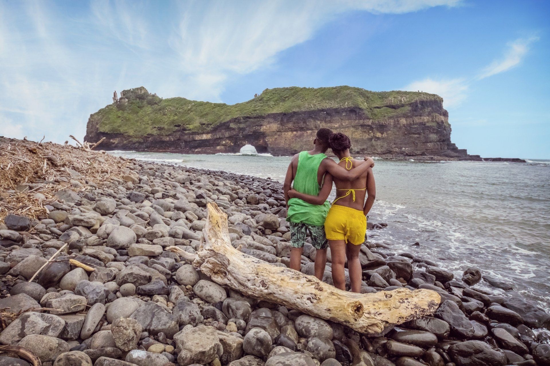
Along the Eastern Cape’s east coast, is the largely untamed and extravagantly beautiful Wild Coast. Craggy, rocky and untamed, the Wild Coast is the pearl in the crown of the Eastern Cape with countless natural attractions and a rich cultural heritage. Kilometre after kilometre of unspoiled coastline, forest and open spaces where you can see sandy beaches, famous shipwrecks and caves.
The former homelands of Transkei and Ciskei have long been less accessible. The infrastructure was not yet completely in order. Today an excellent road connects the areas with Port Elizabeth to the south and Durban to the east. That does not mean that all roads are equally good. In addition to the main roads, you will find numerous gravel roads that are sometimes passable and sometimes not recommended. In order to really enjoy this region, you have to make time for it. The accommodations are located on the coast, which means that you have to get about 90 to 110 kilometers from the main road. We think it is a shame to consider this route only as a transit route; you have to do a lot to get there and then it is also nice to be able to see and experience more of this special region.
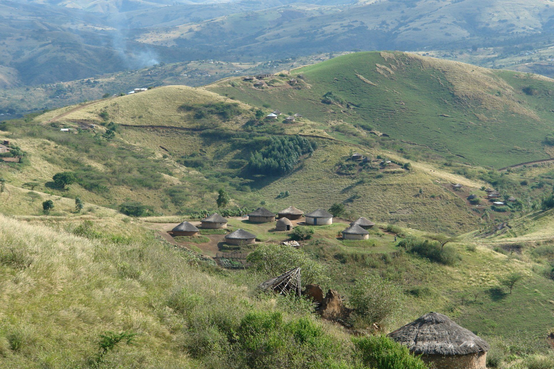
The region is so special because you will find traditional Africa in this area. Round huts and stone houses dot the green hills. Cows, horses and goats walk around criss-cross. People travel on foot from school to home, from watering hole to work. Life here has its own rhythm. It is quite an experience to drive through this landscape and let Africa sink in. Besides the green hills, this region offers you the most beautiful coastline in South Africa. White beaches and a fierce surf provide a beautiful nature. It is not for nothing that the region has been given the name Wild Coast.
The region is the homeland of Madiba, Nelson Mandela. His father was a chieftain in Mvezo, a small spot that can only be reached over 30 kilometers of bad gravel. The hut itself is no longer there; the foundations are visible and the view over the valley is great. A memorial podium has been built on this site with an exhibition about Apartheid. More easily accessible is Qunu, where Mandela spent most of his childhood, and Umtata, where the museum is devoted entirely to the Apartheid struggle and Mandela.
Slide title
Write your caption hereButton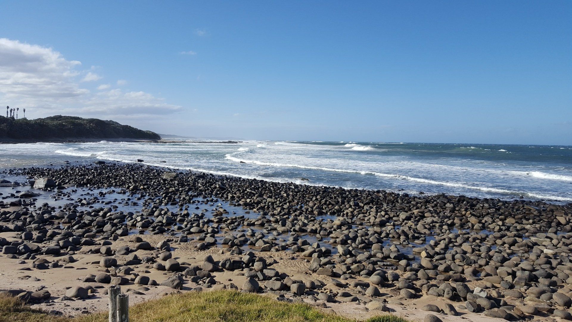
Slide title
Write your caption hereButton
Along the Eastern Cape’s east coast, is the largely untamed and extravagantly beautiful Wild Coast. Craggy, rocky and untamed, the Wild Coast is the pearl in the crown of the Eastern Cape with countless natural attractions and a rich cultural heritage. Kilometre after kilometre of unspoiled coastline, forest and open spaces where you can see sandy beaches, famous shipwrecks and caves.
The former homelands of Transkei and Ciskei have long been less accessible. The infrastructure was not yet completely in order. Today an excellent road connects the areas with Port Elizabeth to the south and Durban to the east. That does not mean that all roads are equally good. In addition to the main roads, you will find numerous gravel roads that are sometimes passable and sometimes not recommended. In order to really enjoy this region, you have to make time for it. The accommodations are located on the coast, which means that you have to get about 90 to 110 kilometers from the main road. We think it is a shame to consider this route only as a transit route; you have to do a lot to get there and then it is also nice to be able to see and experience more of this special region.
The region is so special because you will find traditional Africa in this area. Round huts and stone houses dot the green hills. Cows, horses and goats walk around criss-cross. People travel on foot from school to home, from watering hole to work. Life here has its own rhythm. It is quite an experience to drive through this landscape and let Africa sink in. Besides the green hills, this region offers you the most beautiful coastline in South Africa. White beaches and a fierce surf provide a beautiful nature. It is not for nothing that the region has been given the name Wild Coast.
The region is the homeland of Madiba, Nelson Mandela. His father was a chieftain in Mvezo, a small spot that can only be reached over 30 kilometers of bad gravel. The hut itself is no longer there; the foundations are visible and the view over the valley is great. A memorial podium has been built on this site with an exhibition about Apartheid. More easily accessible is Qunu, where Mandela spent most of his childhood, and Umtata, where the museum is devoted entirely to the Apartheid struggle and Mandela.
GAUTENG PROVINCE
PRETORIA
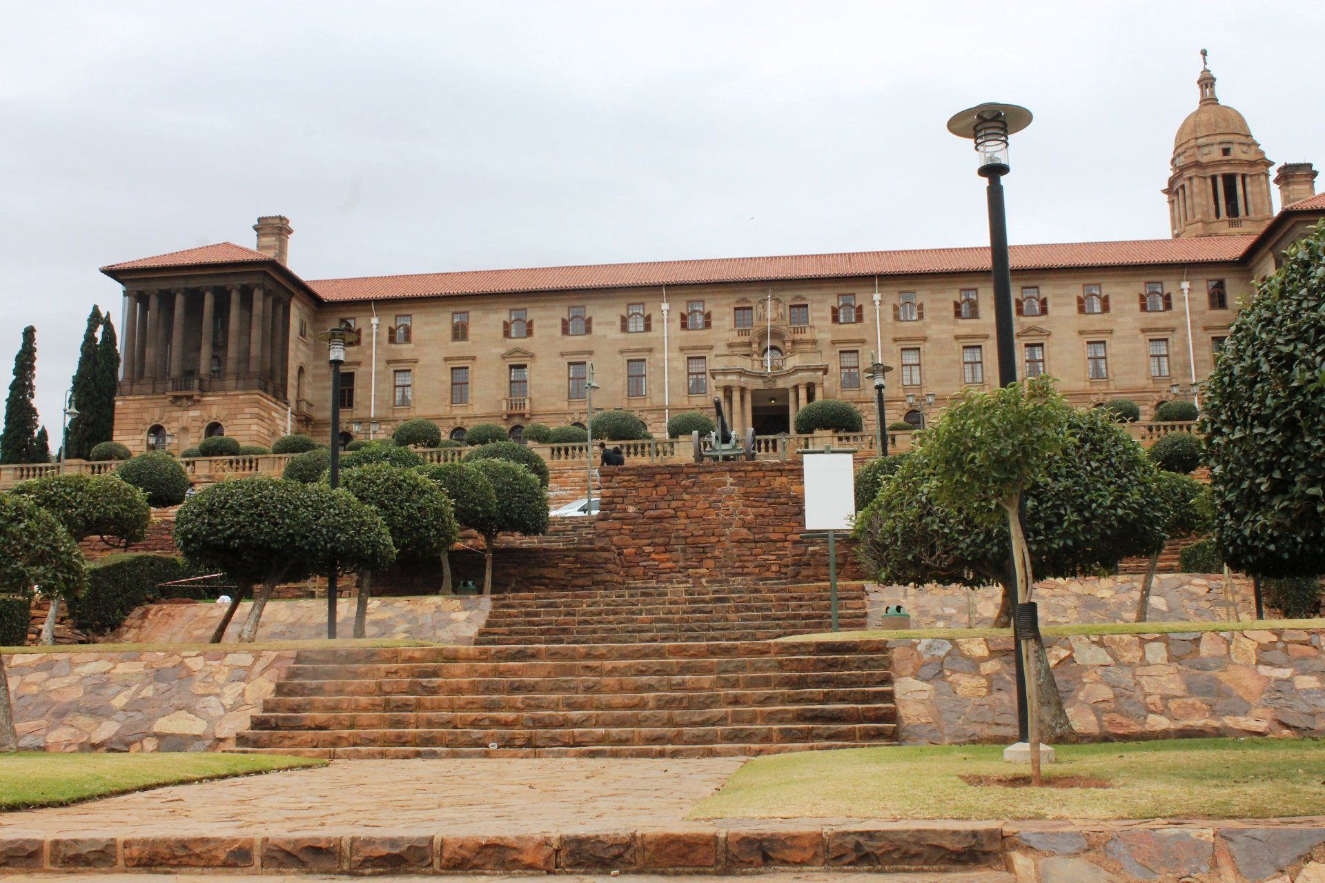
Pretoria, situated in the fertile valley of the Apies River, at the foot of the Magaliesberg range, is the administrative capital of South Africa and the seat of the government for six months of the year. The Ndebele originally occupied the area around Pretoria. The first Voortrekkers arrived in the area, then sparsely populated, in 1827. Boer general M. W. Pretorius founded Pretoria in 1855 and named it after his father Andries Pretorius, whose victory in the battle of Blood River had made possible the establishment of an independent white settlement in the Transvaal. Major tourist attractions in and around the city are the Jacaranda City (named after the many jacaranda trees that blossom in September/October) are: the Voortrekker Monument, Cullinan Mine, Paul Kruger House, Melrose House and the Union Buildings.
CRADLE OF HUMAN KIND
This excursion takes you back to pre-historical times in the Sterkfontein Valley where hominid fossils dating back to 3.5 millions years have been discovered. The Sterkfontein Valley environs; proclaimed as South Africa’s first World heritage Site, includes internationally important fossil sites such as Swartkrans, Ploverslake, Drimolen and Gladysvale, each generating a wealth of fossils crucial to current palaeo-anthropological research. Situated in beautiful and unspoilt wilderness, at a mere 45 minutes drive from Johannesburg, the sites visited are some of the richest fossil sites in Africa. Sterkfontein is the most famous site in the region. This is where the first adult apeman was discovered in 1936 by Dr Robert Broom. The visit is lead by qualified guides, in a refreshing and understandable way, focusing on the fascinating complexities of human evolution. Transfers to the site are either done by road or by air in helicopters. Picnic lunch in the bush or exclusive lunch at the Cradle Restaurant, special tailor-made tours for specific interest groups are available on request.
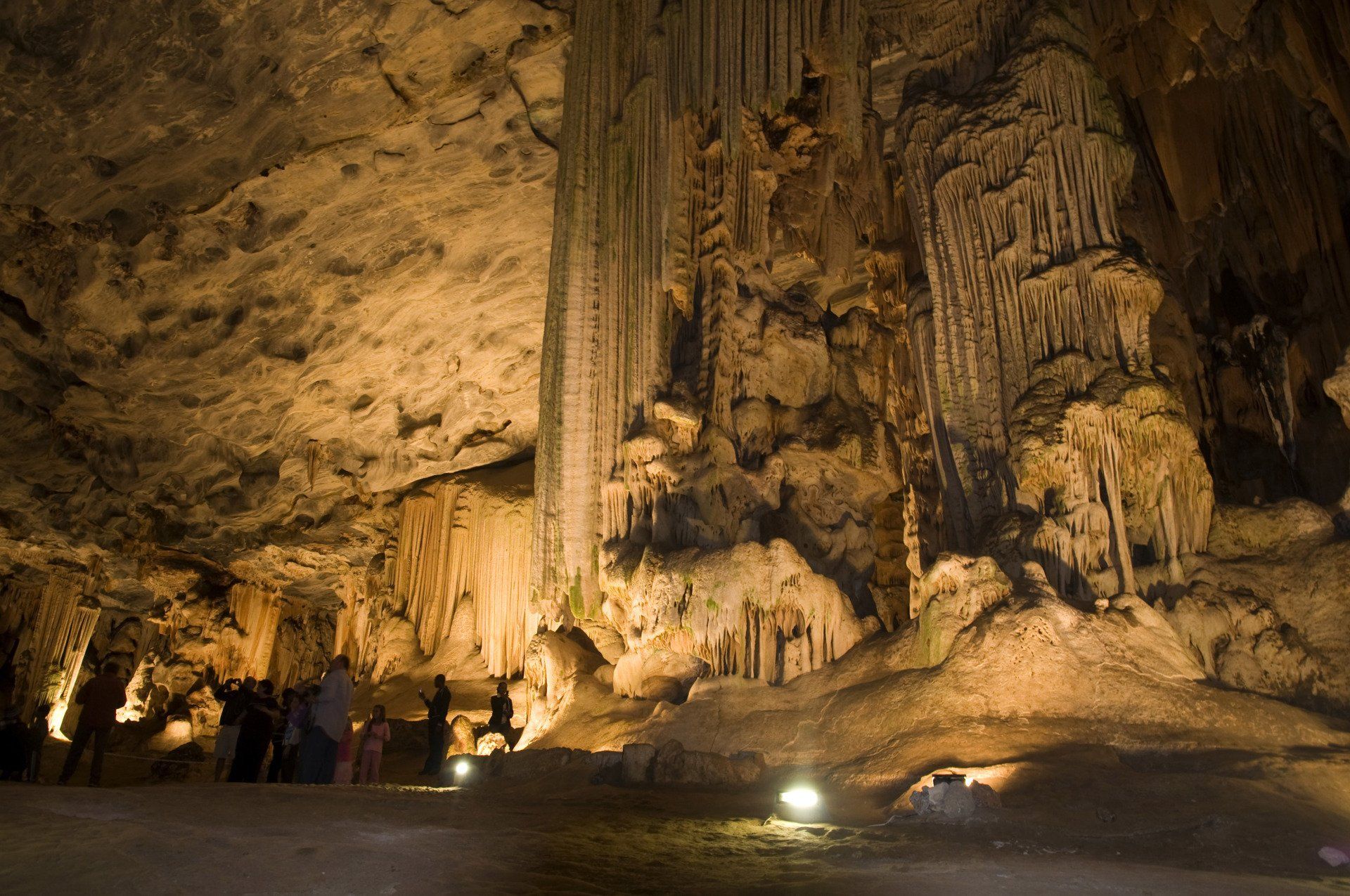
STERKFONTEIN CAVES
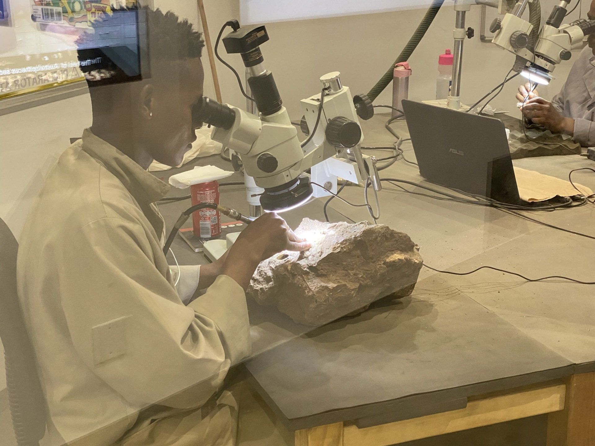
Sterkfontein is the name for a series of limestone caves, northwest of Johannesburg. The caves are from great importance for paleo-antropologists as there are found in the past decades fossils of the early hominids.
The excavations in the caves started at the end of the 19th century but only from 1936 onwards scientists showed more interest into the caves. Up to this day, excavations continue inside the caves near Sterkfonein. Up to now, 500 hominids were found which makes Sterkfontein the richest hominids fossil place in the world.
In the year 2000, Sterkfontein became part of an area known as the Cradle of Human Kind which is a UNESCO World Heritage Site.
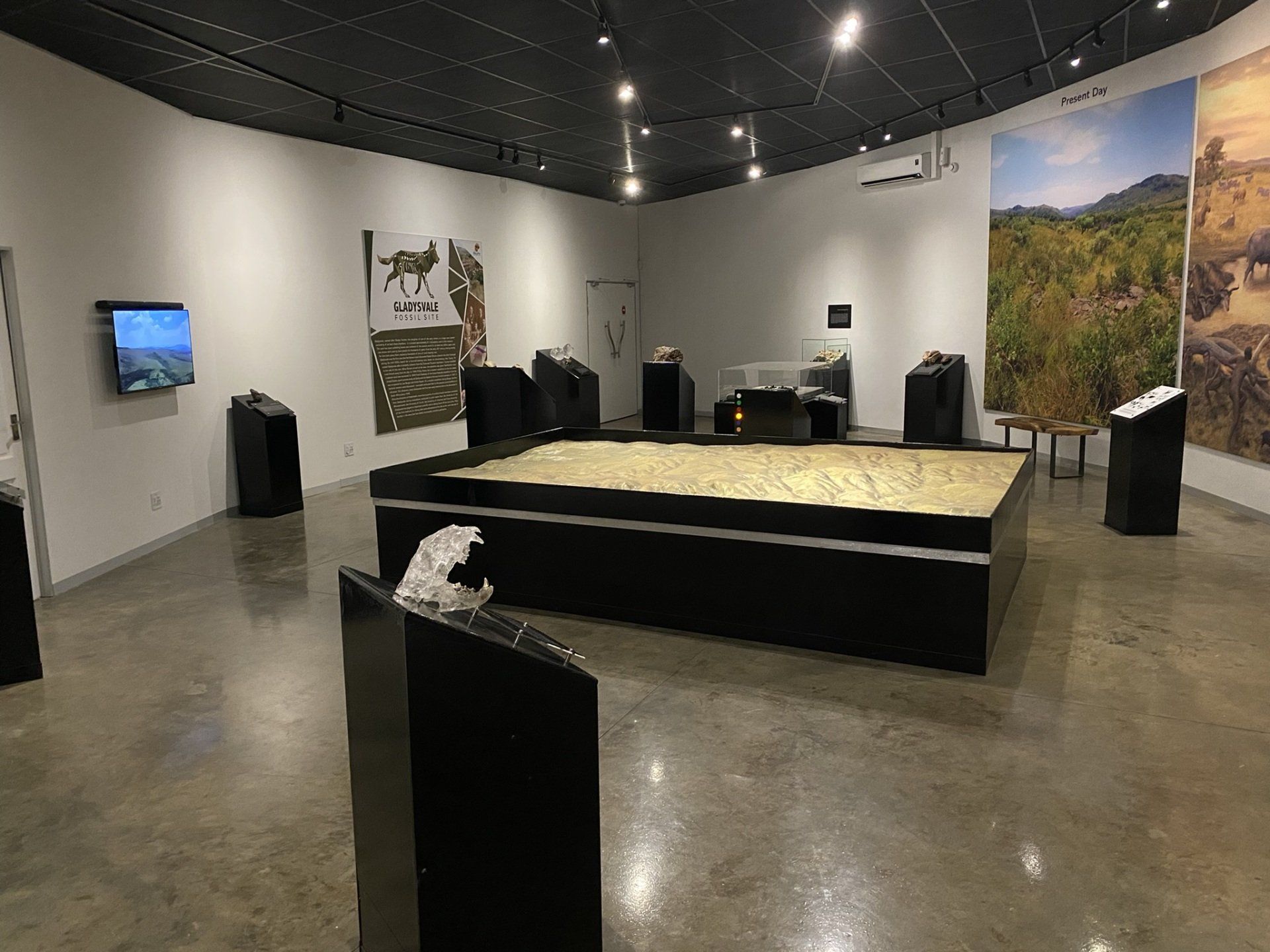
MAROPENG MUSEUM
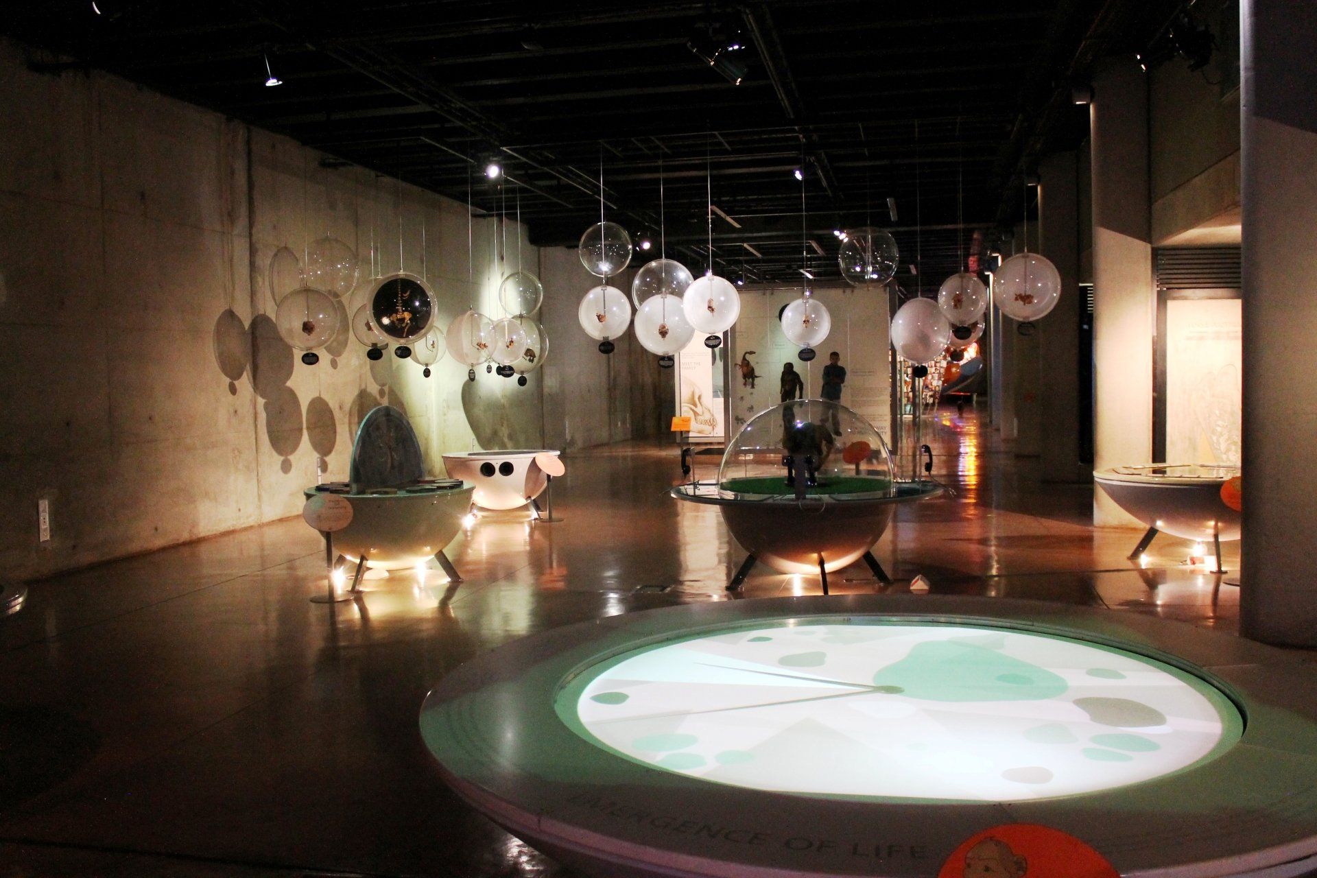
The Maropeng Visitor Centre is an award-winning, world-class exhibition, focusing on the development of humans and our ancestors over the past few million years. Take a journey through time, starting with the formation of the planet and moving all the way through the evolutionary processes that culminated in the world as we know it today. See fossils, learn about how humankind was born, view stone tools that are up to one million years old, and much more. This self-guided, interactive tour allows you to take all the time you need to ponder humanity’s fascinating origin story.
A specialist guide for a private tour in the museum can be arranged.
Slide title
Write your caption hereButton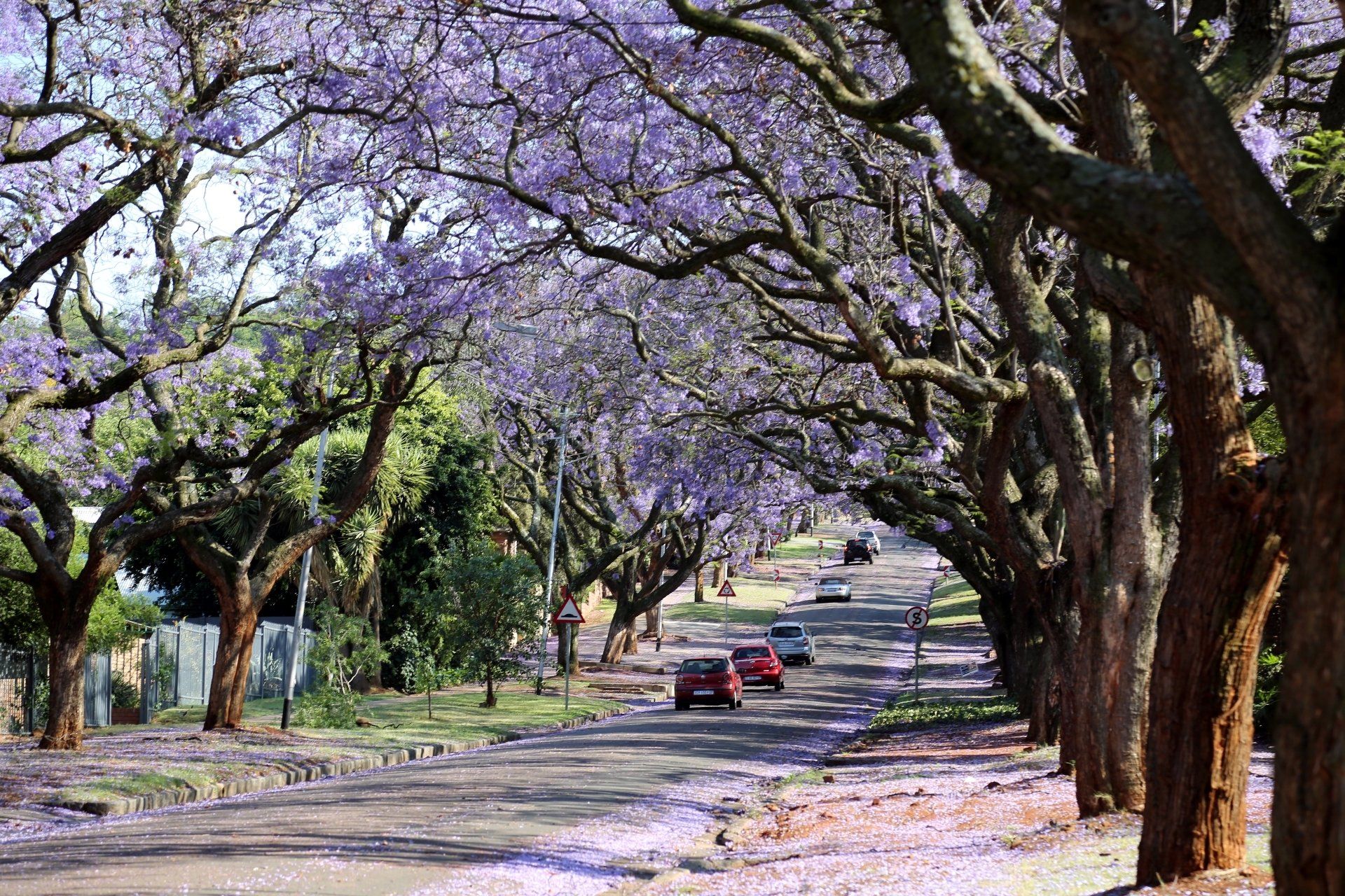
Slide title
Write your caption hereButton
PRETORIA
Pretoria, situated in the fertile valley of the Apies River, at the foot of the Magaliesberg range, is the administrative capital of South Africa and the seat of the government for six months of the year. The Ndebele originally occupied the area around Pretoria. The first Voortrekkers arrived in the area, then sparsely populated, in 1827. Boer general M. W. Pretorius founded Pretoria in 1855 and named it after his father Andries Pretorius, whose victory in the battle of Blood River had made possible the establishment of an independent white settlement in the Transvaal. Major tourist attractions in and around the city are the Jacaranda City (named after the many jacaranda trees that blossom in September/October) are: the Voortrekker Monument, Cullinan Mine, Paul Kruger House, Melrose House and the Union Buildings.
CRADLE OF HUMAN KIND
This excursion takes you back to pre-historical times in the Sterkfontein Valley where hominid fossils dating back to 3.5 millions years have been discovered. The Sterkfontein Valley environs; proclaimed as South Africa’s first World heritage Site, includes internationally important fossil sites such as Swartkrans, Ploverslake, Drimolen and Gladysvale, each generating a wealth of fossils crucial to current palaeo-anthropological research. Situated in beautiful and unspoilt wilderness, at a mere 45 minutes drive from Johannesburg, the sites visited are some of the richest fossil sites in Africa. Sterkfontein is the most famous site in the region. This is where the first adult apeman was discovered in 1936 by Dr Robert Broom. The visit is lead by qualified guides, in a refreshing and understandable way, focusing on the fascinating complexities of human evolution. Transfers to the site are either done by road or by air in helicopters. Picnic lunch in the bush or exclusive lunch at the Cradle Restaurant, special tailor-made tours for specific interest groups are available on request.
STERKFONTEIN CAVES
Sterkfontein is the name for a series of limestone caves, northwest of Johannesburg. The caves are from great importance for paleo-antropologists as there are found in the past decades fossils of the early hominids.
The excavations in the caves started at the end of the 19th century but only from 1936 onwards scientists showed more interest into the caves. Up to this day, excavations continue inside the caves near Sterkfonein. Up to now, 500 hominids were found which makes Sterkfontein the richest hominids fossil place in the world.
In the year 2000, Sterkfontein became part of an area known as the Cradle of Human Kind which is a UNESCO World Heritage Site.
MAROPENG MUSEUM
The Maropeng Visitor Centre is an award-winning, world-class exhibition, focusing on the development of humans and our ancestors over the past few million years. Take a journey through time, starting with the formation of the planet and moving all the way through the evolutionary processes that culminated in the world as we know it today. See fossils, learn about how humankind was born, view stone tools that are up to one million years old, and much more. This self-guided, interactive tour allows you to take all the time you need to ponder humanity’s fascinating origin story.
A specialist guide for a private tour in the museum can be arranged.
GENERAL INFORMATION
-
Visa
European citizen must be in possession of an international passport and a return flight ticket (except when other agreements were obtained by your local South African embassy/consulate). You will be granted a maximum stay of three months in the country. A passport must be at least another 6 months valid on arrival and have at least two blank pages left. The same rules are for most Common Wealth Countries and the United States citizen.
South Africa has introduced the e-visa online system in March 2022, however the system is experiencing a lot of issues (online applications disappear, get no response or are only responded upon to many weeks later.
For more information, please contact your local South African Embassy or consulate.
-
Time
South Africa has the same time as Western Europe during the European summer months. There is a one hour time difference during the European winter. There are no time zones within the country.
-
Customs allowance
Duty-free allowances:
A person under 18 is not entitled to tobacco, cigarettes or drinks allowances. Cigarettes: 200, cigars 20, cigarette or pipe tobacco 250 g, wine: 2 L, spirituous or other alcoholic beverages: 1 L, perfume: 50 ml, toilet water: 250 ml, gifts, souvenirs and all other goods: R3000.
Flat Rate Assessment:
you may elect to pay duty at a flat rate of 20% on goods up to a value of R12.000 over and above your duty free allowances.
-
Tip
Service charge is not included, a tip of 10% is given and 1 – 2 rand at petrol stations. It is also recommended to tip local guides.
-
VAT
VAT can be claimed back at the airport. Keep the payment slips from your purchased goods. The payment slips should show ‘VAT number’, VAT amount paid, the total payment and a short description of the purchased goods (not valid for consumption goods like wine, photo rolls, batteries…). The paperwork can be prepared at the Victoria & Alfred Waterfront in Cape Town (take your passport and flight ticket/e-ticket with you).
Preparing the documents at the Waterfront will safe you much time as the goods only have to be showed at the airport. It is of course also possible to arrange everything at the airport but it can be time consuming during peak season. In case you have a domestic flight before leaving the country, refund can only be done at the international airport where you take your international flight.
-
Population
South Africa has an estimated 54 million people spread out over the 9 provinces. The federal government is based in Cape Town, Pretoria (today Tswane) is the administrative capital and Bloemfontein the juridical capital.
Bordered by two oceans: the Atlantic and the Indian, South Africa is a fascinating country whether one focuses on its history, the diversity of its inhabitants, cultures, or the splendour of its landscape.
The first Dutch sailors set foot at the Cape of Good Hope in April 1652, a first step that would eventually lead to three and a half centuries of conflict and violence, shaping the destiny of the people of South Africa. From the British occupation to the reign of the Great Shaka of the Zulus, from the Great Trek to the Anglo-Boer wars, from the official onset of Apartheid to the election of Nelson Mandela in 1994, history has left its mark in the memories of South Africans.
Now, however, South Africa is a democratic country of about 40 million inhabitants, and 11 official languages: Afrikaans, English, Xhosa and Zulu being dominant. To describe their country, Desmond Tutu and Nelson Mandela use the expression “The Rainbow Nation”.
With its 3000 kilometre-long coastline, its tropical beaches, mountain ranges, bush areas and deserts, South Africa is also a land of natural beauties. Numerous National Parks teeming with flora and big game allow for many an opportunity to go on memorable scenic- and game-drives. Each and every area boasts a typical flora and fauna. Among others, one might expect to spot lions, cheetahs, elephants, giraffes, eagles and ostriches, seals, penguins, whales and many more. South Africa is a paradise for nature lovers.
-
Electricity
The power net in South Africa works on 220V – 50Hz. Some hotels provide European two pin adaptors while others have international power point in a desk. It is advisable to buy an adaptor in any supermarket.
-
Climate
South Africa is in the southern hemisphere, this means that the seasons are different than in the northern hemisphere. The winter months are June and July. Rain and even snow in the mountains around the Cape is common during winter while night temperature in the Karoo can drop way below zero. The weather in Augustus changes, rain is still possible but the temperatures are on the rise, nights are still cool. August and September are the true springtime months.
Heavy snowfall in the Drakensberg is normal during winter.
Day temperatures in the north (Limpopo, Mpumalanga and Kwazulu Natal) are lovely (up to 25?C), the nights are cool. The winter months are the dry season in the African savannah, this is the ideal time for safari as the lush green is dry and the change to see game larger.
The hottest months of the year are December and January. There is a moderate to very strong south easterly wind in the Cape (Cape Doctor) which can be compared with the mistral winds in south Europe.
-
Safety
Be aware of pickpockets and street children. Try to act inconspicuous and preferably do not take any money out of bank machines (ATM) on the street. It is better to take money inside the bank or ATM within the building.
Driving at night is not to be recommended!
The general emergency number is: 10111.
-
Traffic
We drive in South Africa on the left. The maximum speed is 120 km/h, on provincial roads 100 km/h, in the city 60 km/h. Maximum alcohol level in the blood is 0.5.
Driving on the complete left, over the yellow line is a traffic offence. This is a manoeuvre which a lot of people do, some how it is generally accepted but keep in mind that this is extremely dangerous (pedestrians, cyclists…). It is and stays a traffic offence and can be fined.
Most petrol stations are 24h open. Payment per credit card is not possible, only cash. Cooling water and oil level is checked. A small tip is appreciated.
-
Transport
Public transport is simply dangerous. Travelling by train, even in first class is very dangerous except on the big routes such as the Trans Karoo or the Algoa Train. The privately operated trains such as the Blue Train and Rovos Rail are absolutely safe!
Travelling between the big cities by bus is safe. It is possible to take a minibus taxi within the cities, this kind of public transport is cheap but very dangerous on the long distance routes (the vehicles are not always road worthy! A minibus taxi can be stopped anywhere at any time. Meter taxi is expensive. It is recommended to have your own rental vehicle.
-
Water
Drinking tap water is very safe! The drinking water in Cape Town belongs to the best in the world from all major cities. Do not drink from pools, rivers or unknown source.
-
Telephone & Internet
Public phones are hard to find and/or no longer in operation. The cheapest way of phoning with a cell phone is buy your own chip card.
Dialing abroad is recently with the ’00’ international access code.
Internet is available in most hotels and there are internet cafes in the cities.
WIFI-internet is widely available at hotels and lodges. Data vouchers are for purchase at petrol stations, supermarkets and at the telephone/internet provider shops.